A Land Surveyor's Companion

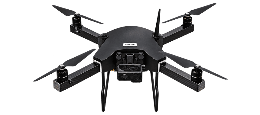
Meet SURVEYAAN VI

India's Most Advanced Type Certified Drone for Precision Surveying

India's Most Affordable
Type Certified Drone

Cloud Based
Photogrammetry Built-In

Survey 60 Hectares
in 25 Minutes

Download The Brochure
Certified BadgeSurveyaan V1 DGCA type certified drone India for land survey and mapping
SpecValue
Flight Time25–30 Min
Range1.5 Km
CategoryMicro
Weight1.99 Kg

A Land Surveyor's Companion for Extended Surveys

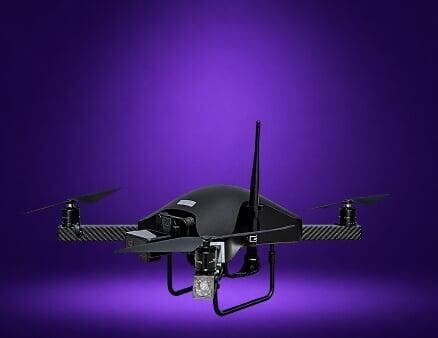
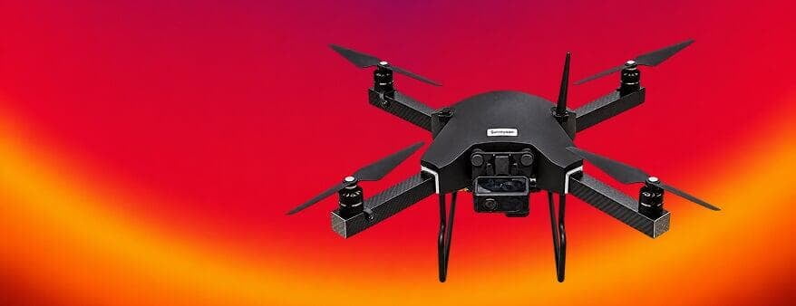
The Surveyaan V1 is India's most affordable DGCA type certified drone, purpose-built for professional land surveyors, consultants, and survey firms. Designed and manufactured in India by Nibrus Technologies, it combines military-grade carbon fiber construction with a plug-and-play workflow that gets you airborne in under 2 minutes.

Whether you're surveying agricultural land, construction sites, mining areas, or corridors, the Surveyaan V1 delivers survey-grade accuracy with X/Y within 10 cm and Z within 15 cm — at a price point that is 10x more affordable than traditional solutions. With 600+ customers and 20L+ acres processed, it is the most trusted type certified drone in India today.

Drone survey

Fully Autonomous Operations

Extended flight time

Easy to Setup

Survey range

Modular Design & Payload Versatile

A True Companion for Large and
Enterprise Scale Surveying

A Land Surveyor's Companion For Extended Surveys

REQUEST PRICE
Quad-Rotor icon

Drone Type Quad-Rotor

Camera icon

23 MP Camera

Weight icon

1.99 kg Micro Category

Speed icon

Max Speed 25 km/hr

Surveyaan V1 –
Mapping Drone Has Never
Been So Easy to Use

A Land Surveyor's Companion for Extended Surveys

Surveyaan V1 Drone
Time icon

25–30 Mins

Flight Time

Range icon

1.5 Km

Range

Height icon

120 m Max

Height

Wind icon

Up-to 25 km/hr

Wind Resistance

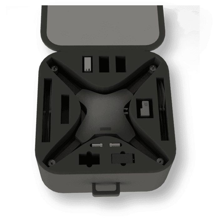
We have taken care about your transport easiness also!

  • 50cm × 50cm Bag
  • 4 Kg Weight
  • Tripod Included
Surveyaan drone packed inside its 50cm hard transport case with foam cutouts
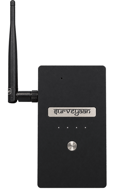
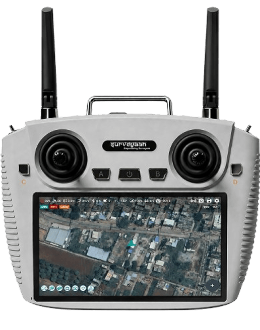
Surveyaan Ground Station

Elevate Your Drone Operations Using
Our Advanced Ground Station

A Land Surveyor's Companion For Extended Surveys

Weight
200 Gm
Weight
Wi-Fi
Wi-Fi
Connect
Real Time
Real Time
Info
Capacity
15 Wh
Capacity

Frequent questions

Lightning-fast and full-featured — make every survey faster, more accurate, and more profitable by using Surveyaan V1.
Is Surveyaan V1 a surveying drone?
Yes. Surveyaan V1 is a professional DGCA type certified surveying drone designed specifically for land survey and mapping applications. It generates accurate 2D orthomosaic maps and 3D terrain models with millions of data points per flight — making it an ideal tool for land surveyors, consultants, and survey firms across India.
How easy is it to fly the Surveyaan V1?+
The Surveyaan V1 is designed to be extremely easy to operate — even for first-time drone users. Simply open the ground control app, mark your survey area on the map, and the drone handles everything autonomously from takeoff to landing. The entire setup and pre-flight process takes under 2 minutes, and no manual flying skills are required for survey missions.
Is Surveyaan V1 affordable for small and medium scale surveying businesses?+
Yes, absolutely. The Surveyaan V1 is India's most affordable DGCA type certified survey drone — allowing small and medium surveying firms to set up a complete drone-based survey business at up to 10 times less investment compared to other solutions available in India. The complete ecosystem including the drone and GeoWorkspace software is priced under ₹5 lakhs.
Is it easy to transport and carry the Surveyaan V1 to any survey site? +
Yes. The Surveyaan V1 is designed with field portability in mind. The complete kit — including the drone, battery, charger, and accessories — weighs just 4 kg and fits into a compact 50cm × 50cm carry bag that can be easily carried by a single operator to any survey site. A surveying tripod is also included in the kit right out of the box.
What accuracy can be achieved with the Surveyaan V1?+
Using the inbuilt GPS, the Surveyaan V1 generates maps with X and Y accuracy within 10 cm and Z accuracy within 15 cm. If Ground Control Points (GCPs) are used with a DGPS system, the map accuracy improves further to match the accuracy of the DGPS used — providing survey-grade deliverables suitable for professional engineering and planning applications.
What materials are used to manufacture the Surveyaan V1?+
The Surveyaan V1 is manufactured using high-grade carbon fiber composite and machining-grade plastic — materials chosen for their exceptional strength-to-weight ratio, durability, and resistance to vibration. This construction ensures the drone can withstand the rigours of regular field use across India's varied terrain and climate conditions while maintaining its structural integrity over thousands of flight cycles.
What happens if the battery gets depleted during a survey mission?+
The Surveyaan V1 is equipped with an automatic Return to Home (RTH) feature that activates when the battery level drops below a safe threshold during a mission. The drone will automatically stop the mission, return to its home point, and land safely — without requiring any manual intervention from the operator.
Can the Surveyaan V1 resume a mission if the battery runs out mid-flight?+
Yes. The Surveyaan V1 is equipped with a resume functionality that allows the drone to continue an incomplete survey mission after a battery swap. Once the drone returns to the home point due to low battery, simply insert a fully charged battery and the drone will automatically resume the mission from exactly where it stopped — ensuring no coverage area is missed. We recommend keeping at least one extra battery on the field for uninterrupted survey operations.
How many batteries are included with the Surveyaan V1?+
The standard Surveyaan V1 kit comes with one battery. Additional batteries can be requested at any time and are strongly recommended for field operations — particularly for larger survey areas that require multiple flights. We recommend that every operator carries at least one extra fully charged battery to the field to take full advantage of the resume functionality and maximise daily survey output.
Can the Surveyaan V1 be operated in high wind or rain conditions? +
The Surveyaan V1 is rated for wind resistance of up to 25 km/hr and is not recommended for use in wind speeds exceeding this limit or in rain conditions. If rainfall begins during an active survey mission, the drone is equipped with failsafe features that will automatically return it to the home point and land safely — protecting both the drone and your survey data. Always check local weather conditions before deploying the Surveyaan V1 on any survey mission.
Surveyaan App

A Control App Which Is So
Intuitive That You Virtually
Need No Training!

REGISTER NOW

Get in Touch with India's
leading Commercial Drone/
UAV Manufacturers

Have Questions About Our Surveying Drones Or Photogrammetry Software?

Phone
+91-9606922556
Email
info@nibrus.in

Head Office

Nibrus Technologies Private Limited
#125/12, 3rd Floor, Sulikunte Village,
Muthanallur Cross, Sarjapura Main Road,
Bengaluru - 562125

Send us a message

TRUSTED BY 600+ GLOBAL CLIENTS