Surveyaan
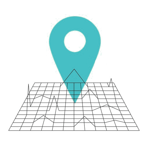
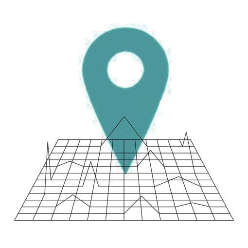
GeoWorkspace
Surveyaan
GeoWorkspace
How Geoworkspace Works
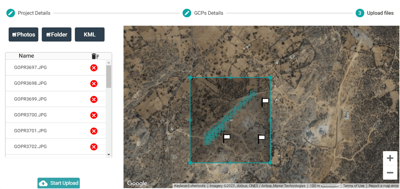

Upload
Upload GCP and Images to the cloud software

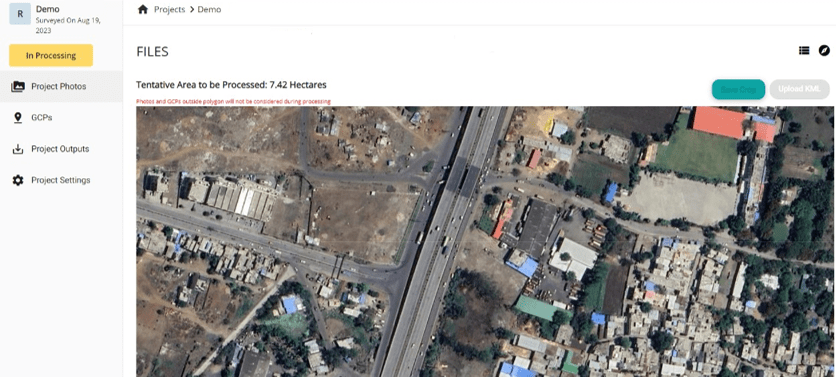
Process
The data is processed using AI automatically

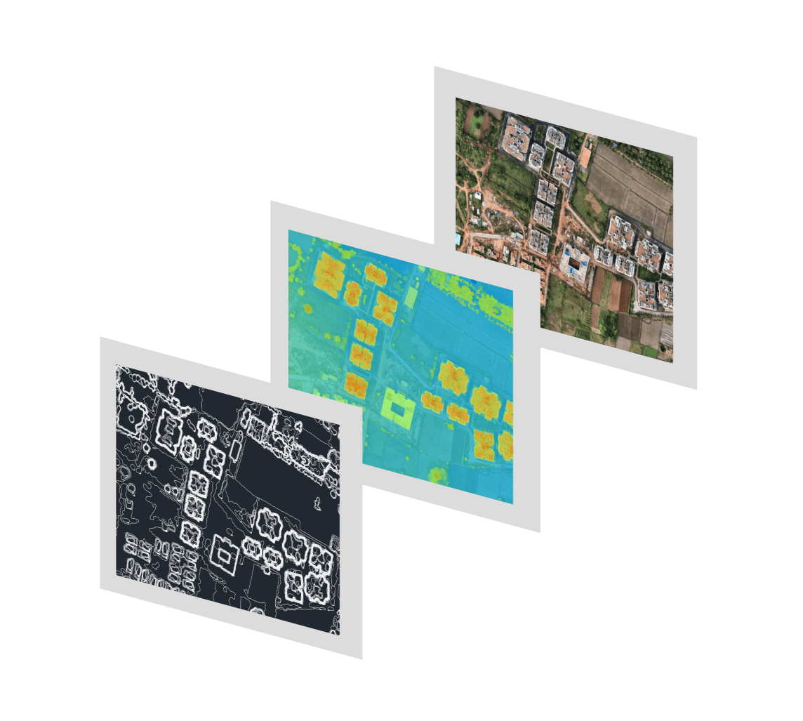
Export
Export multiple outputs in just few clicks
How Geoworkspace Works
Upload
Upload GCP and Images to the cloud software
Process
The data is processed using AI automatically
Export
Export multiple outputs in just few clicks
How Geoworkspace Works
Upload
Upload GCP and Images to the cloud software
Process
The data is processed using AI automatically
Export
Export multiple outputs in just few clicks
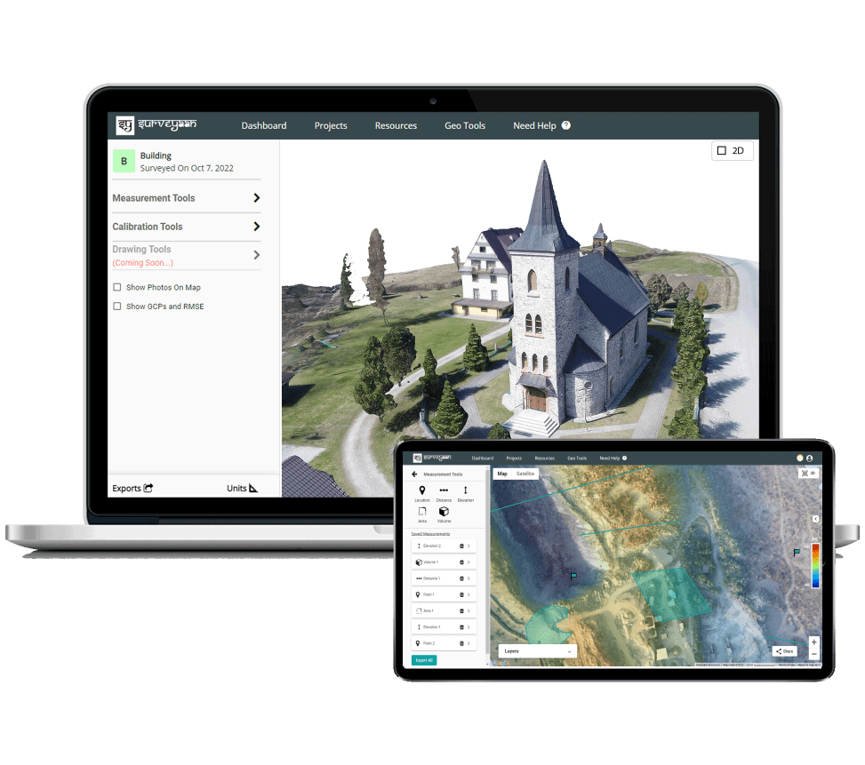
Main Features

Data Security and Storage
This data can be accessed anytime, anywhere since the data is stored in the cloud. There is no risk of loasing the data.


Fast and Easy Measurements
There are 5 measurement tools from where you can measure distance, elevation, area and volume on your data.
High Accuracy and Detail
The Cloud photogrammertry software can produce highly detailed and accurate 3D models and point clouds with high-resolution images and appropriate processing techniques.

Collaboration and Sharing
The data can be accessed anytime, anywhere since the data is stored in the cloud
Main Features
Data Security and Storage
This data can be accessed anytime, anywhere since the data is stored in the cloud. There is no risk of loasing the data.
Fast and Easy Measurements
There are 5 measurement tools from where you can measure distance, elevation, area and volume on your data.
High Accuracy and Detail
The Cloud photogrammertry software can produce highly detailed and accurate 3D models and point clouds with high-resolution images and appropriate processing techniques.
Collaboration and Sharing
The data can be accessed anytime, anywhere since the data is stored in the cloud
Surveying Outputs
Orthomosaic Maps
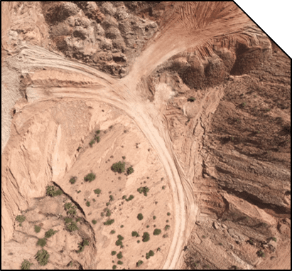
2D Georeferenced Textured Map
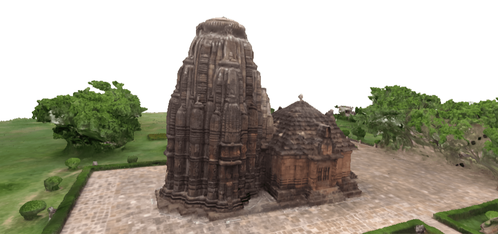
3D Reconstruction
3D Point Cloud
Textured Map
3D Model
Digital Elevation Model
Georeferenced Elevation Model
AutoCAD Project
AutoCAD Compliable
(DXF/DWG) File
Surveying Outputs
Orthomosaic Maps
2D Georeferenced
Textured Map
3D Reconstruction
3D Point Cloud
Textured Map
3D Model
Digital Elevation Model
Georeferenced
Elevation Model
AutoCAD Project
AutoCAD Compliable
(DXF/DWG) file
Surveying Outputs
Orthomosaic Maps
2D Georeferenced
Textured Map
3D Reconstruction
3D Point Cloud
Textured Map
3D Model
Digital Elevation Model
Georeferenced
Elevation Model
AutoCAD Project
AutoCAD Compliable
(DXF/DWG) file
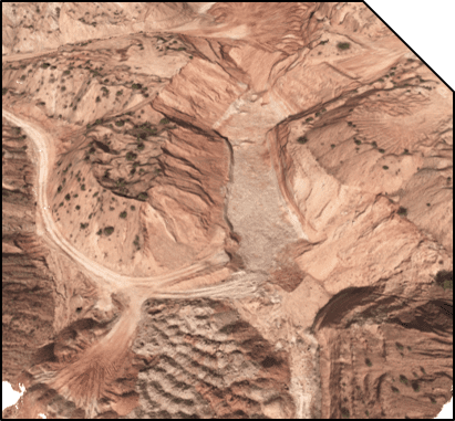
Accurate 3D and 2D Models
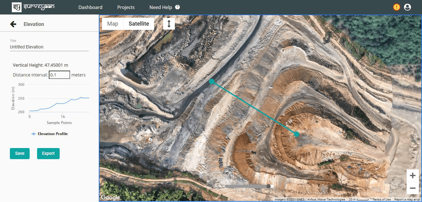
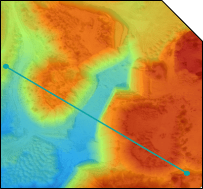
Elevation Profiles using DTM & DSM
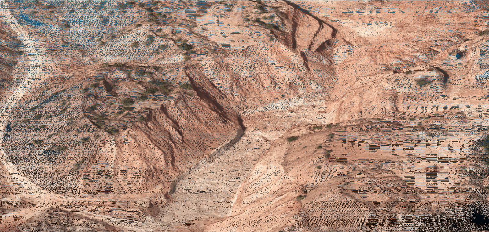
Visualize Point Clouds with Reality Captured Data
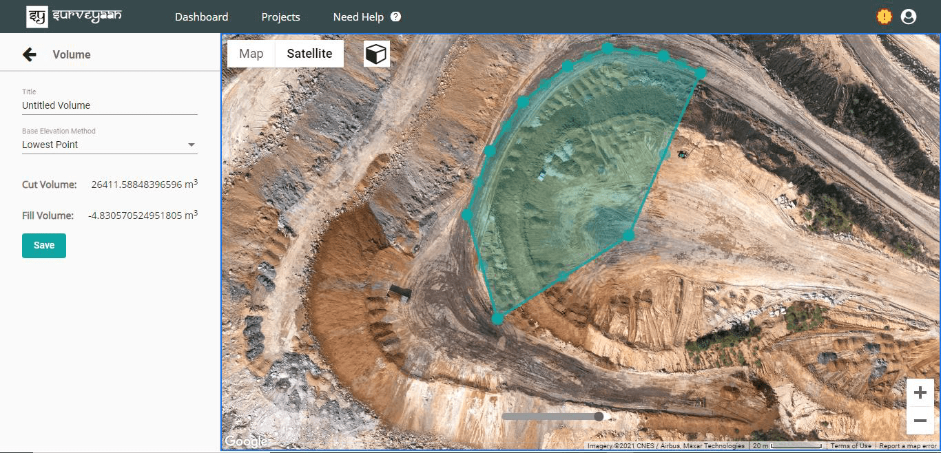
Volumetric Measurements
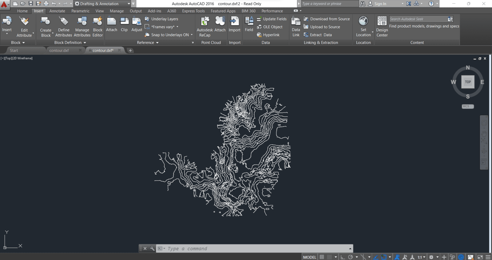
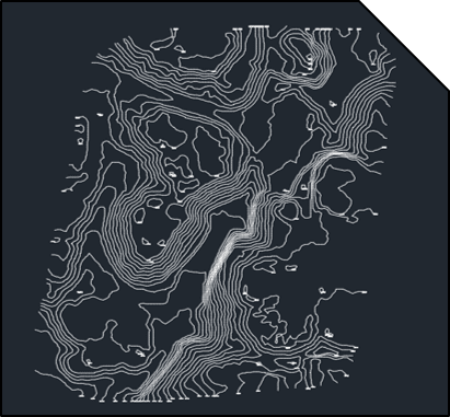
AutoCAD and GIS Compatible Contours and Points
Accurate 3D and 2D Models
Accurate 3D and 2D Models
Elevation Profiles using DTM & DSM
Elevation Profiles using DTM & DSM
Visualize Point Clouds with Reality Captured Data
Visualize Point Clouds with Reality Captured Data
Volumetric Measurements
Volumetric Measurements
AutoCAD and GIS Compatible Contours and Points
AutoCAD and GIS Compatible Contours and Points
Accurate 3D and 2D Models
Elevation Profiles using DTM & DSM
Visualize Point Clouds with Reality Captured Data
Volumetric Measurements
AutoCAD and GIS Compatible Contours and Points
can also export LC sections as well.
Frequently Asked Questions
Frequently Asked Questions
Our Valued Partners
Our Valued Partners


Our Dealers
Our Dealers


Contact Us
Get in Touch with Us
Do not hesitate to contact us with any queries.
