Use Cases
Drones has emerged as an effective tool for mine planners and consultants in last few years. They provide an array of benefits to consultants keeping safety of personnel. Also the time these professional spend on field can be reduced drastically. Below are the few of the applications:
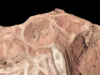
Stockpile Volume Estimation
- Calculate the stockpile volume and amount of material removed from the ground at different timeframes
- Measure Accurate Excavations
- Cut and Fill Volumes with Lightning fast speed
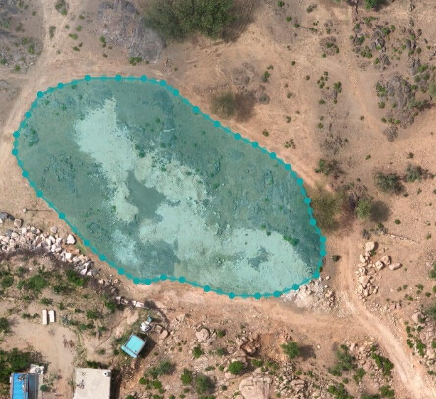
Mine Planning and Mapping
- Preperation of Mine Plans
- Safe and Strategic Mine Operations
- Structural Information
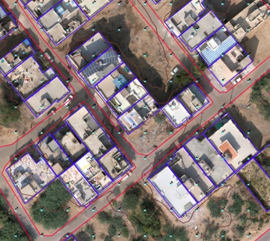
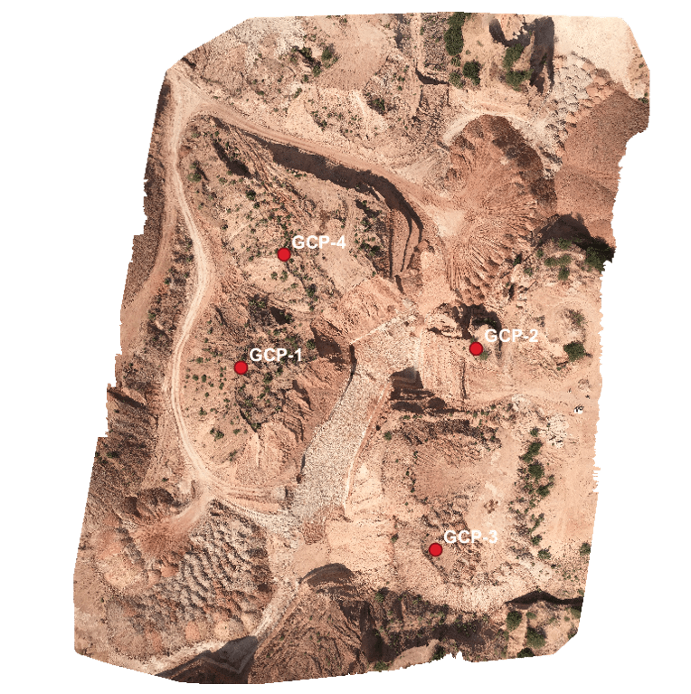
Asset and Area Mapping
- Identify and Mark Mining Assets
- GCP Planning and Management
Note: All the outputs above are generated using our photogrammetry software Surveyaan GeoWorkspace.
Use Cases
Drones has emerged as an effective tool for mine planners and consultants in last few years. They provide an array of benefits to consultants keeping safety of personnel. Also the time these professional spend on field can be reduced drastically. Below are the few of the applications:
Stockpile Volume Estimation
Stockpile Volume Estimation
- Calculate the stockpile volume and amount of material removed from the ground at different timeframes
- Measure Accurate Excavations
- Cut and Fill Volumes with Lightning fast speed
Mine Planning and Mapping
Mine Planning and Mapping
- Preperation of Mine Plans
- Safe and Strategic Mine Operations
- Structural Information
Asset Area and Mapping
Asset Area and Mapping
- Identify and mark Mining assets
- GCP Planning and Management
Note: All the outputs above are generated using our photogrammetry software Surveyaan GeoWorkspace.
