Use Cases
Solar projects require 2D and 3D maps of site weather it is land or a rooftop before even commencement of the project. Consultants require these maps for planning and analysis purposes. Also aerial survey happens to be an effective way to monitor the constructed project.Below are few of the benefits Surveyaan brings on the table for solar consultants:
Rooftop Survey
- Rooftime Development Planning
- 3D modeling of site
- Progress Reporting
Note: All the outputs above are generated using our photogrammetry software Surveyaan GeoWorkspace.
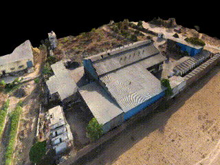
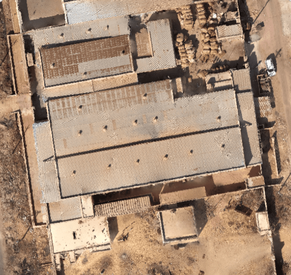
Use Cases
Solar projects require 2D and 3D maps of site weather it is land or a rooftop before even commencement of the project. Consultants require these maps for planning and analysis purposes. Also aerial survey happens to be an effective way to monitor the constructed project.Below are few of the benefits Surveyaan brings on the table for solar consultants:
Rooftop Survey
- Rooftop development planning
- 3D modelling of the site
- Progress reporting
Note: All the outputs above are generated using our photogrammetry software Surveyaan GeoWorkspace.
