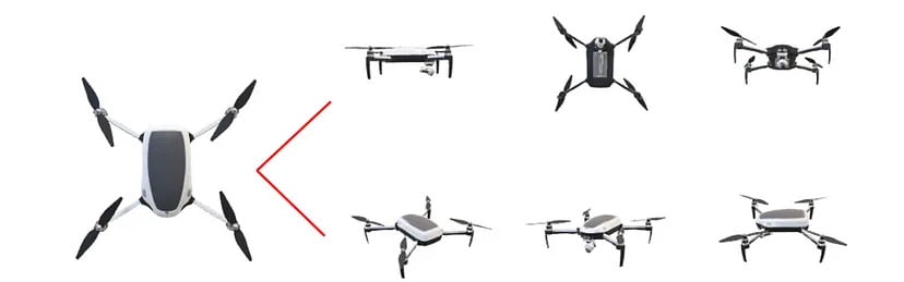
In a world where technology is always evolving, drone surveys have become the unsung heroes of data mapping and collection. Among their many superpowers, perhaps the most captivating is their ability to create 3D models. They capture a bunch of images from different angles, and software stitches them together to create a detailed, three-dimensional map of the area. In this blog, we’ll explore the magic behind 3D models in drone surveys and unveil the countless applications that make them an vital tool in various industries.
What is a 3D Model?
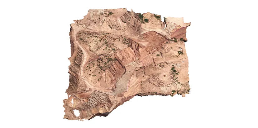
A 3D model is a digital representation of a physical object or scene created using computer software. The process of creating a 3D model involves designing the shape and structure of the object using specialized software tools. Once the model is created, it can be manipulated and viewed from different angles to provide a detailed understanding of its dimensions and appearance. The main advantage of using photogrammetry is its ability to reproduce an object with an especially high quality of texture.
A 3D model is a digital representation of a physical object or scene created using computer software. The process of creating a 3D model involves designing the shape and structure of the object using specialized software tools. Once the model is created, it can be manipulated and viewed from different angles to provide a detailed understanding of its dimensions and appearance. The main advantage of using photogrammetry is its ability to reproduce an object with an especially high quality of texture.
For e.g. If you need to design something completely new that hasn’t yet been created, 3D modeling is the perfect way to let your imagination run wild and bring your ideas to life.
Understanding 3D Mesh and Textures
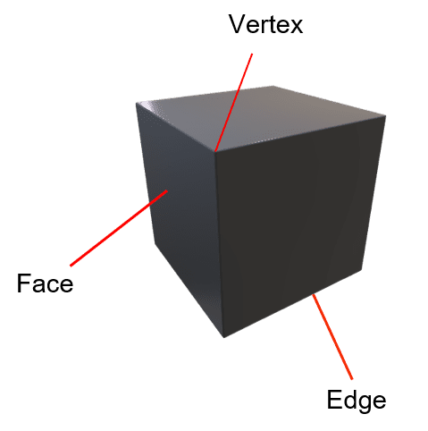
It is essentially a collection of vertices, edges, and faces that define the shape and structure of a 3D object. With 3D mesh, models can be created with intricate details that make them look realistic.
It is essentially a collection of vertices, edges, and faces that define the shape and structure of a 3D object. With 3D mesh, models can be created with intricate details that make them look realistic.
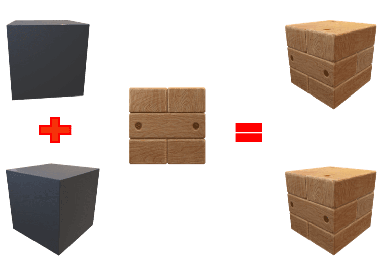
Textures, like strokes of a digital brush, add the finishing touches to the mesh
For e.g. If you need to design something completely new that hasn’t yet been created, 3D modeling is the perfect way to let your imagination run wild and bring your ideas to life.
Applications
- Urban Planning: City planners now have a powerful tool at their disposal. 3D models enable them to visualize potential developments, assess infrastructure needs, and optimize city layouts for efficiency and aesthetics.
- Agriculture: Farmers harness the capabilities of drone surveys to monitor crop health, assess soil conditions, and plan irrigation. This data-driven approach enhances precision agriculture, leading to better yields and resource utilization.
- Environmental Monitoring: Keeping a watchful eye on ecosystems is crucial for conservation efforts. Drones equipped with sensors can capture detailed 3D models of natural habitats, aiding researchers in monitoring changes, identifying potential threats, and implementing effective conservation strategies.
- Construction: In the realm of construction, architects and engineers leverage 3D models to visualize projects before breaking ground. This helps in detecting potential issues, optimizing designs, and streamlining the construction process.
Different Formats
Certain file formats store various kinds of information about 3D models. The most common file types supported are:
- OBJ —Its full form is Object File. It is one of the more important file formats in 3D printing and 3D graphics applications. It stores 3D objects that contain polygonal faces, texture maps, 3D coordinates, and other object information.
- FBX — Its full form is Filmbox. It is a proprietary file format that can store information on a model’s geometry, texture, color, and other appearance-related properties. It’s mostly used when working with film and video games.
- 3DS — Its full form is 3D Studio. It is a proprietary Autodesk file format that stores geometry, animation, and basic information on the appearance of the model. The 3DS format is mostly used in academic, engineering, architecture, and production domains.
