Blog categorized as Drone Survey
LiDAR (Light Detection and Ranging) is a remote sensing technology that uses laser pulses to measure distances.
SurveyGyaan by Surveyaan
02.07.25 12:07 PM - Comment(s)
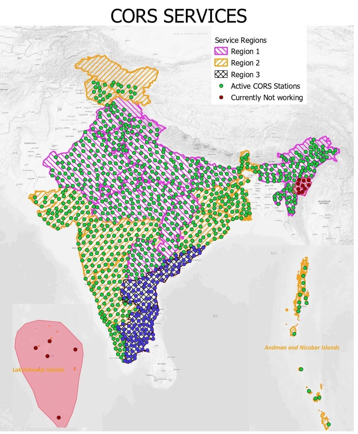
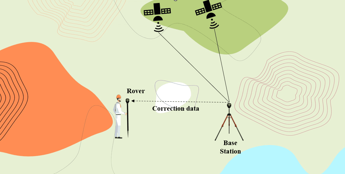
The Continuous Operating Reference Station (CORS) networks positioning services are amongst the most used ones when the highest positioning accuracy is needed.
SurveyGyaan by Surveyaan
09.02.24 08:22 AM - Comment(s)
Global Navigation Satellite System (GNSS) technology has transformed how we navigate and collect location-based data
SurveyGyaan by Surveyaan
02.02.24 12:37 PM - Comment(s)
Global Navigation Satellite System (GNSS) technology has transformed how we navigate and collect geospatial data.
SurveyGyaan by Surveyaan
18.01.24 01:22 PM - Comment(s)
In this blog, we will look at various forms of GNSS errors and how they affect accuracy.
SurveyGyaan by Surveyaan
10.01.24 06:30 AM - Comment(s)
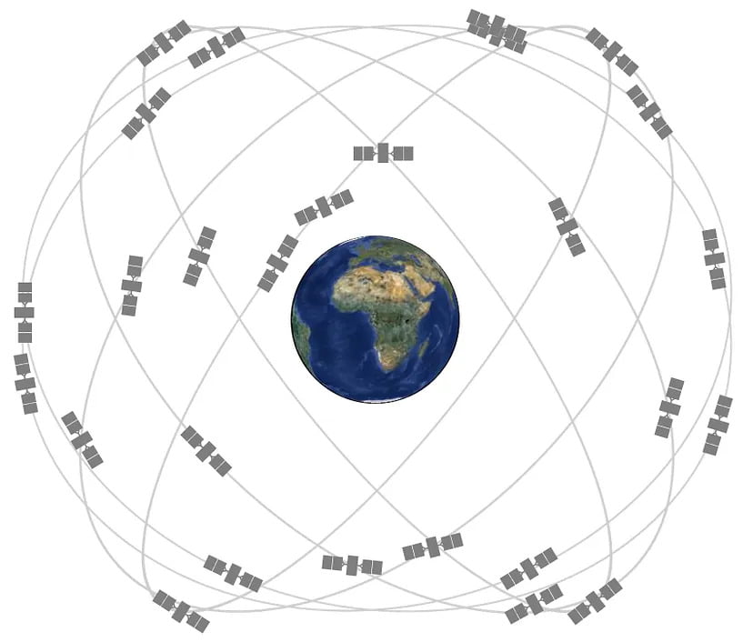
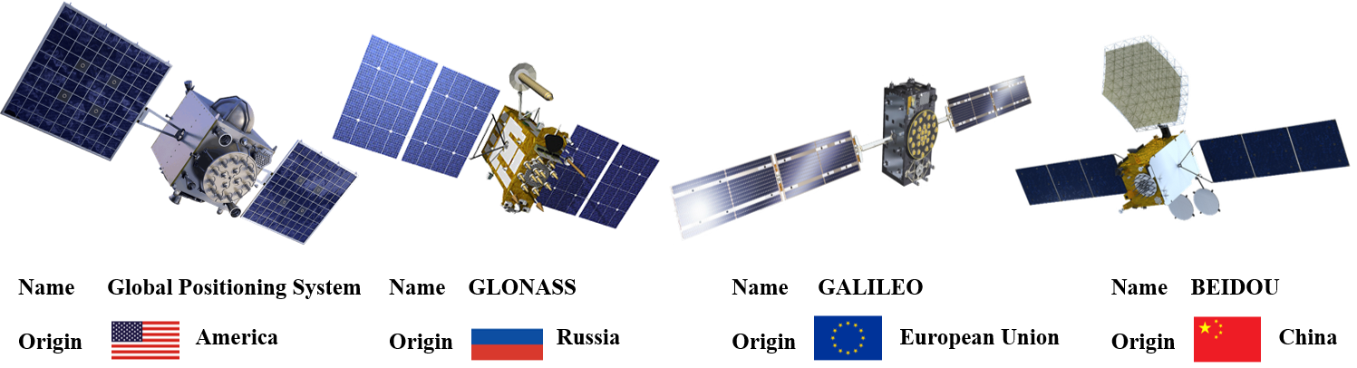
In this blog, we’ll take a closer look at the major GNSS satellite constellations, exploring their features, functions, and the global impact of these constellations.
SurveyGyaan by Surveyaan
09.01.24 01:17 PM - Comment(s)
In this blog, we will unravel the diverse domains where accuracy is not just a preference but an absolute necessity and also take you on a journey into the cosmos of GNSS.
SurveyGyaan by Surveyaan
09.01.24 12:57 PM - Comment(s)
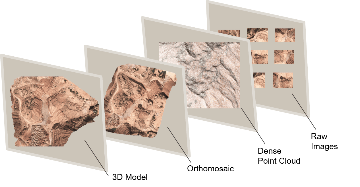
In this blog, we’ll explore the magic behind 3D models in drone surveys and unveil the countless applications that make them an vital tool in various industries.
SurveyGyaan by Surveyaan
09.01.24 12:16 PM - Comment(s)
In this blog, we will look at how point clouds are used in drone surveying and how this technology is changing the way we collect and analyze spatial data.
SurveyGyaan by Surveyaan
09.01.24 10:54 AM - Comment(s)
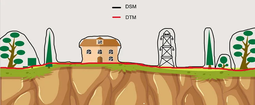
This blog will explain what DEMs are, how they differ, and how they can dramatically improve drone surveying efforts.
SurveyGyaan by Surveyaan
09.01.24 07:37 AM - Comment(s)
Surveying is a crucial aspect of civil engineering and construction projects, providing accurate measurements and data for planning, design, and implementation
SurveyGyaan by Surveyaan
08.01.24 11:12 AM - Comment(s)
With the advancement in drone technology, various sensors have been integrated into the drones to improve the sensitivity of drones.
SurveyGyaan by Surveyaan
08.01.24 08:29 AM - Comment(s)
The Government has updated the SOP for drone surveys and submission of Digital Aerial Images of Mining areas to the Indian Bureau of Mines.
SurveyGyaan by Surveyaan
08.01.24 07:01 AM - Comment(s)
Standard Operating Procedure (SOP) addresses guidelines for the drone pilot to follow during flight, pre-flight and post-flight procedures to ensure the highest degree of safety.
SurveyGyaan by Surveyaan
08.01.24 06:29 AM - Comment(s)
The Government released several sets of instructions to allow the operation of UAV drones called the Standard Operating Procedures for carrying out drone survey
SurveyGyaan by Surveyaan
06.01.24 01:44 PM - Comment(s)
