The field of surveying and mapping has changed dramatically in recent years, thanks to the introduction of drone technology and the incorporation of point cloud data. These unmanned aerial vehicles (UAVs) have become vital tools for a variety of businesses, providing a cost-effective and efficient method of collecting high-resolution data from the sky. In this blog, we will look at how point clouds are used in drone surveying and how this technology is changing the way we collect and analyze spatial data.
What is a Point Cloud ?
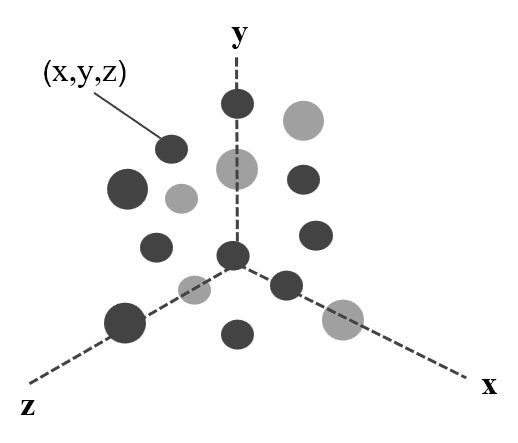
A point cloud is a set of data points in a three-dimensional coordinate system that represents the external surface of an object or a scene. A point cloud is a collection of points in 3D space, where each point represents a specific coordinate. Point clouds can be generated through various methods, including photogrammetry, laser scanning, etc.
A point cloud is a set of data points in a three-dimensional coordinate system that represents the external surface of an object or a scene. A point cloud is a collection of points in 3D space, where each point represents a specific coordinate. Point clouds can be generated through various methods, including photogrammetry, laser scanning, etc.
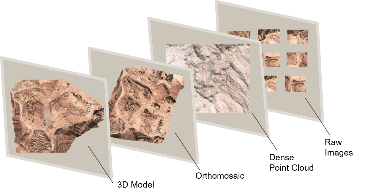
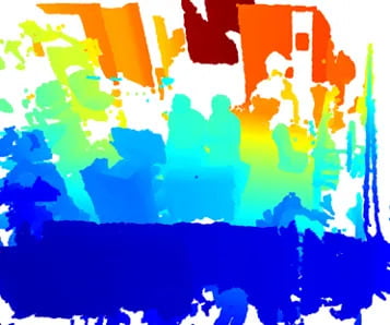
The above illustration shows how the other photogrammerty outputs are generated using point cloud
How Point Clouds Enhance Drone Surveying ?
Point clouds play a pivotal role in enhancing drone surveying in several ways. Here are some key points explaining how they contribute to the effectiveness of drone-based surveying:
Point clouds play a pivotal role in enhancing drone surveying in several ways. Here are some key points explaining how they contribute to the effectiveness of drone-based surveying:
- Precision and Accuracy: The exceptional precision and accuracy provided by point clouds in drone surveying is one of the most significant advantages. Drones with LiDAR sensors or high-resolution cameras may collect millions of data points in a single trip, ensuring that even the smallest details are captured. This level of precision is crucial in applications such as land surveying, where every inch counts.
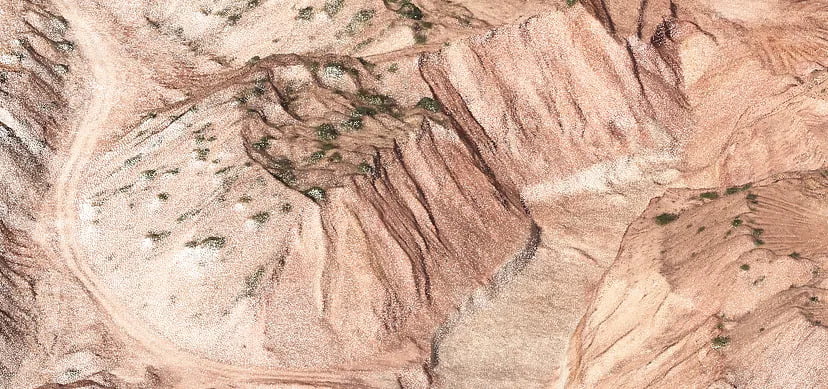
- 3D Visualization: Point clouds make it possible to create highly detailed 3D representations of surveyed locations. This not only provides a visually engaging picture of the world, but it also enables detailed investigation of structures, topography, and items. This 3D perspective assists architects, engineers, and urban planners in making educated construction, development, and design decisions.
- Rapid Data Collection: Drone technology is well-known for its speed and efficiency. This speed is increased when paired with point cloud data. Drones can swiftly capture broad areas, lowering data collection time and resources.
- Data Integration and Analysis: Drone-captured point cloud data can be readily incorporated into a variety of software applications for further analysis. This data can be used to extract features, detect changes, and produce accurate digital terrain models (DTMs) and digital surface models (DSMs). Point cloud data serves as the foundation for a variety of GIS (Geographic Information System) and CAD (Computer-Aided Design) applications, allowing for data-driven decision-making.
Applications
The combination of point clouds and drone technology has numerous applications in a variety of industries:
The combination of point clouds and drone technology has numerous applications in a variety of industries:
- Construction and Engineering: Drones outfitted with LiDAR may efficiently monitor building progress, check structures, and provide detailed as-built documentation in construction and engineering. This speeds up the construction process, ensures quality control, and aids in the detection and resolution of concerns.
- Agriculture: Drone point clouds help with agriculture by monitoring crop health, optimizing irrigation, and measuring soil quality. Farmers can use this information to make data-driven decisions that increase crop output, reduce resource waste, and lessen environmental impact.
- Environment Management: Drone-captured point clouds are useful for analyzing natural resources such as forests, wetlands, and coastal regions. This technology is used by environmentalists and conservationists to monitor changes in these ecosystems, track deforestation, and safeguard biodiversity.
- Archaeology: Drones equipped with point cloud technology are used to build detailed 3D representations of historical locations and relics. This contributes to the preservation of cultural heritage, archeological study, and careful documenting of significant historical monuments.
Different Formats of Orthomosaic Map
Point cloud data is often saved in a variety of forms to accommodate different applications and software tools. Here are some typical point cloud data formats:
Point cloud data is often saved in a variety of forms to accommodate different applications and software tools. Here are some typical point cloud data formats:
- LAS (Lidar Aerial Survey): It is a standardized and widely accepted format for storing and exchanging lidar-derived point cloud data. It provides essential metadata and attributes, enabling accurate and detailed representation of the physical environment in a structured and interoperable manner, making it a key component in various applications, including topographic mapping, forestry management, urban planning, and more.
- LAZ(LASzip): The LAZ (LASzip) file format is a compressed version of the LAS (LIDAR Aerial Survey) file format used for storing LiDAR point cloud data. It maintains the essential attributes of LAS data but uses a more space-efficient compression algorithm. LAZ files are often used when storage or data transfer efficiency is a priority.
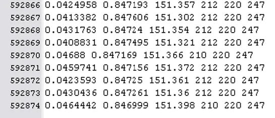
- ASCII: These formats are plain text and store point cloud data as a series of lines with space- or comma-separated values for X, Y, Z coordinates, and optionally, additional attributes such as intensity.
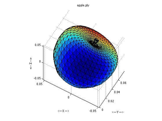
- PLY (Polygon File Format): PLY is a flexible format often used for both point cloud and 3D mesh data. It can store point clouds in ASCII or binary format. PLY files also allow for custom attributes and can be used for both point cloud and mesh data, making them versatile for 3D modeling applications.
- BIN (Binary Point Cloud Format): A generic binary format that stores point cloud data without any specific standardization. Its simplicity makes it a flexible option for applications that don’t require extensive metadata.
Point clouds significantly enhance the capabilities of drone surveying by providing accurate, detailed, and comprehensive spatial data. This integration of technology is instrumental in improving decision-making, reducing risks, and increasing the efficiency of various applications across industries, ultimately contributing to better-informed and more sustainable practices.
