In the fast-evolving field of geospatial technology, LiDAR surveying using drones is transforming how we map, measure, and manage the Earth’s surface. Whether it’s infrastructure planning, surveying, mining, forestry, or topographic mapping — LiDAR-equipped UAVs (Unmanned Aerial Vehicles) are becoming indispensable tools for professionals across industries.
In this blog, we’ll explore what LiDAR drone surveying is, how it works, its benefits, applications, and why it is a game-changer for modern surveying.
Quick Question Before We Start:
Have you ever used a drone for work or fun?
What is LiDAR Surveying?
Imagine a technology that can see through trees, map ancient ruins, and even help self-driving cars navigate — that’s LiDAR!
LiDAR (Light Detection and Ranging) is a remote sensing technology that uses laser pulses to measure distances. These pulses are emitted from a LiDAR sensor, bounce off surfaces, and return to the sensor, allowing it to calculate the precise distance between the object and the sensor. When mounted on a drone, LiDAR can collect millions of points per second — creating highly accurate 3D point clouds of terrain and structures. LIDAR is an ideal system for a variety of industries, including the civil engineering, roadwork and mining industries.
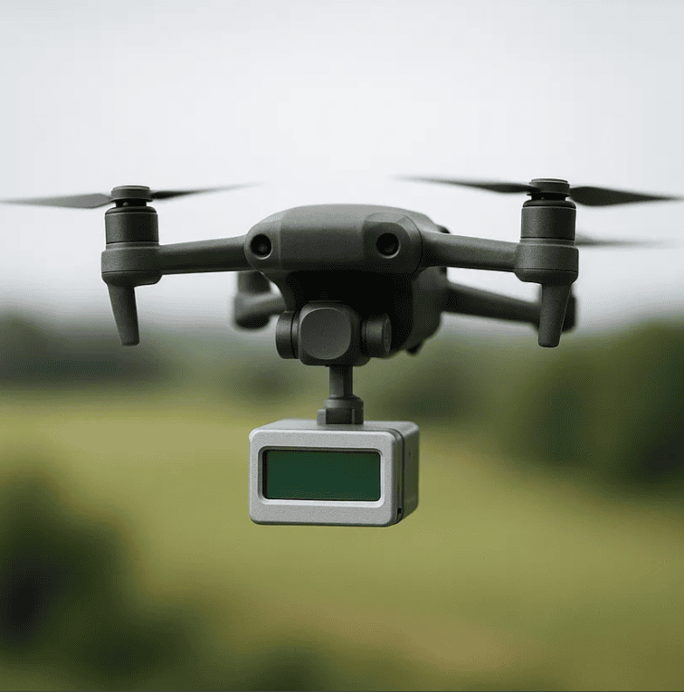
What is a LiDAR Drone?
It is simply a UAV (Unmanned Aerial Vehicle) equipped with a LiDAR (Light Detection and Ranging) sensor.
How Does LiDAR Drone Technology Work?
- Laser Pulses: The LiDAR sensor sends out rapid laser pulses — often hundreds of thousands per second.
- Return Signal: The laser hits a surface (ground, building, tree) and reflects back to the sensor.
- Distance Calculation: The time it takes for the laser to return is used to calculate the exact distance.
- 3D Model Creation: Combining all these points, software generates highly detailed 3D maps, called point clouds.
This process allows surveyors to generate accurate Digital Elevation Models (DEMs), Digital Terrain Models (DTMs), and Digital Surface Models (DSMs).
Why Use a LiDAR Drone?
Highly Accurate
LiDAR drones can produce centimeter-level accuracy, making them ideal for topographic surveys, construction planning, and engineering projects.
Vegetation Penetration
Unlike cameras, LiDAR lasers can penetrate vegetation, allowing you to see the ground beneath trees and brush — crucial for forestry, archaeology, and environmental monitoring.
Faster Data Collection
Drone-based LiDAR surveys can cover large areas quickly — reducing time, labor, and cost compared to ground-based methods.
Safe and Remote Access
LiDAR drones can access steep, dangerous, or remote areas, reducing risk for field crews.
Think About It:
If LiDAR can “see through” foliage, where else could it be useful?
🌳 Forestry
🏗 Construction sites
🏛 Archaeology
Real-World Applications
Construction & Engineering
No more guesswork! LiDAR drones create ultra-precise 3D models of construction sites.
Cut costs by tracking stockpile volumes automatically.
Smart Farming
Monitor crop health by scanning fields in minutes.
Optimize irrigation with detailed elevation maps.
Mining & Quarries
Measure stockpiles without climbing dangerous piles.
Detect slope instability before collapses happen.
Forestry & Environment
Count trees and estimate timber volume.
Track deforestation with millimeter-level accuracy.
Did You Know?
LiDAR helped discover lost Mayan cities hidden under thick jungle!
Challenges & Limitations
High Initial Costs: Professional LiDAR drones cost $20,000–$100,000+.
Data Processing Complexity: Requires specialized software & expertise.
Regulatory Restrictions: Airspace regulations limit drone operations in urban areas.
Battery Life Constraints: Most drones have 20–40 min flight times, requiring multiple sorties.
LiDAR-equipped drones are transforming surveying by providing fast, accurate, and cost-effective geospatial data. Whether for construction, agriculture, mining, or urban planning, this technology enhances efficiency and decision-making.
This brings us to the end of the blog. I hope this article gained some knowledge for you!
Thank you for reading.
About SurveyGyaan
SurveyGyaan is an educational initiative under the Surveyaan brand, which is a subsidiary of Nibrus Technologies Private Limited. Surveypod specializes in DGNSS/DGPS manufacturing in INDIA.
