Blog tagged as ground control point
LiDAR (Light Detection and Ranging) is a remote sensing technology that uses laser pulses to measure distances.
SurveyGyaan by Surveyaan
02.07.25 12:07 PM - Comment(s)
In this blog, we’ll break down what DGNSS and drone surveying are, how they work together, and why industries like mining, construction, road and railway departments are shifting to these modern tools.
SurveyGyaan by Surveyaan
02.07.25 10:44 AM - Comment(s)
Surveying is a crucial aspect of civil engineering and construction projects, providing accurate measurements and data for planning, design, and implementation
SurveyGyaan by Surveyaan
08.01.24 11:12 AM - Comment(s)
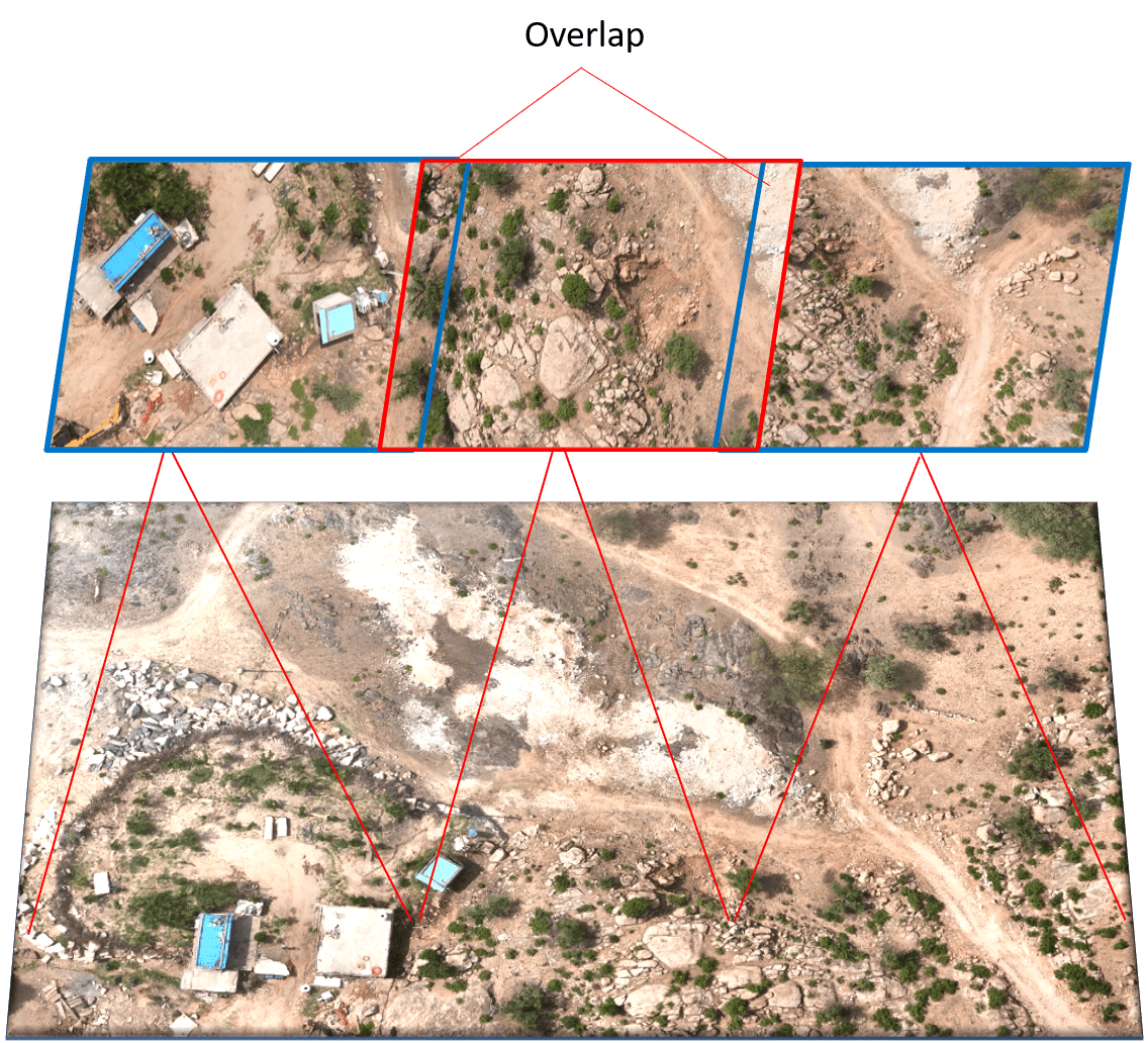
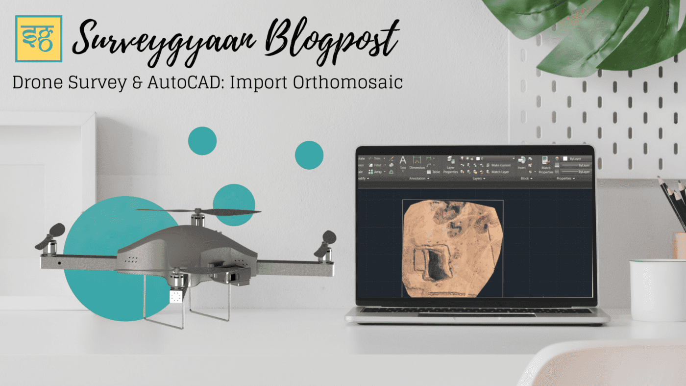
Photogrammetry is the technology of creating 3D models, orthomosaics, point clouds, or other geospatial data from a series of overlapping photographs or images.
SurveyGyaan by Surveyaan
08.01.24 11:12 AM - Comment(s)
Standard Operating Procedure (SOP) addresses guidelines for the drone pilot to follow during flight, pre-flight and post-flight procedures to ensure the highest degree of safety.
SurveyGyaan by Surveyaan
08.01.24 06:29 AM - Comment(s)
The Government released several sets of instructions to allow the operation of UAV drones called the Standard Operating Procedures for carrying out drone survey
SurveyGyaan by Surveyaan
06.01.24 01:44 PM - Comment(s)

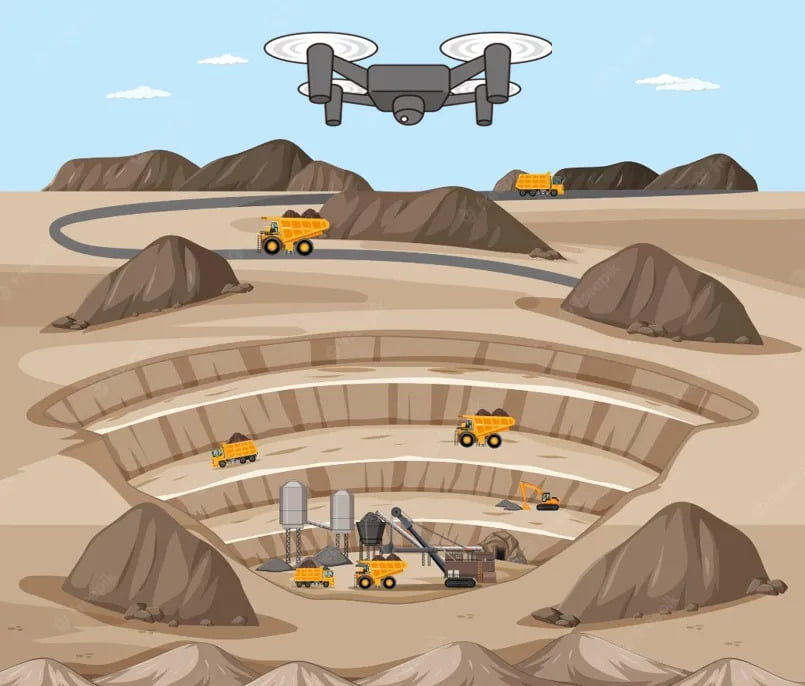
Mining is the extraction of valuable minerals or other geological materials from the earth.
SurveyGyaan by Surveyaan
05.01.24 01:38 PM - Comment(s)
We saw the initial planning phase of drone mapping in one of our previous blog. In this blog, we will discuss the Data Collection phase and how paramount it is to choose the right
SurveyGyaan by Surveyaan
21.12.23 01:34 PM - Comment(s)
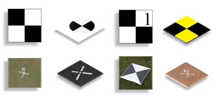
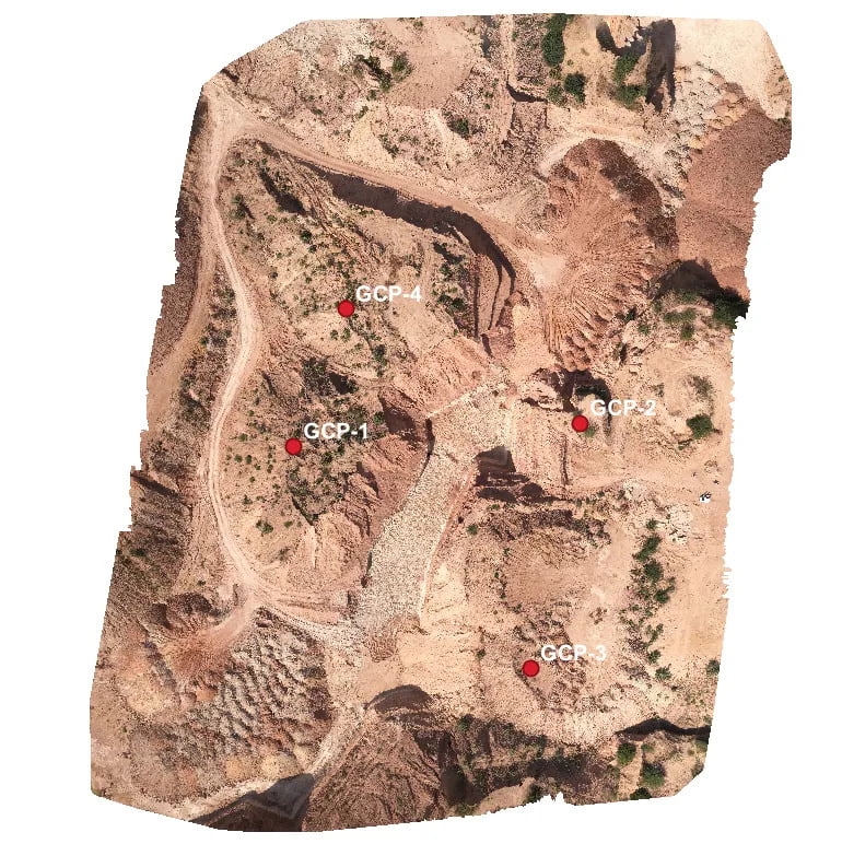
Ground Control Points (GCPs) are defined as the points on the surface of the earth which help to georeference raster data such as satellite, aerial, or drone imagery.
SurveyGyaan by Surveyaan
06.12.22 05:46 AM - Comment(s)
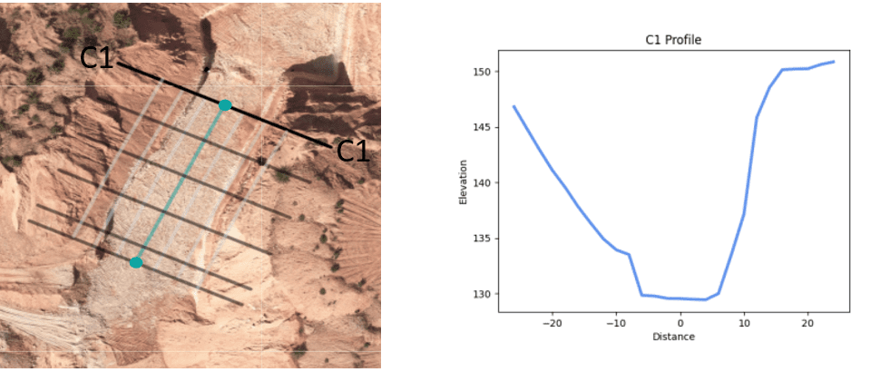
Volumetric surveys are topographical surveys that accurately quantify the volume of material removed from or placed at a location.
SurveyGyaan by Surveyaan
06.12.22 05:46 AM - Comment(s)
Surveying is a process of determining or identifying different features of a land area. It helps in planning or mapping an area.
SurveyGyaan by Surveyaan
26.01.22 06:07 AM - Comment(s)
