Blog tagged as Surveygyaan
LiDAR (Light Detection and Ranging) is a remote sensing technology that uses laser pulses to measure distances.
SurveyGyaan by Surveyaan
02.07.25 12:07 PM - Comment(s)
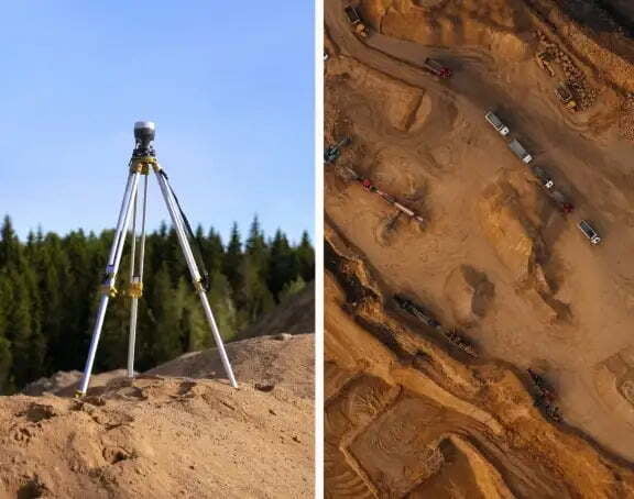
In this blog, we’ll break down what DGNSS and drone surveying are, how they work together, and why industries like mining, construction, road and railway departments are shifting to these modern tools.
SurveyGyaan by Surveyaan
02.07.25 10:44 AM - Comment(s)

In this blog, we’ll explore the importance of IMU in GNSS, how it enhances accuracy, and why it’s a game-changer for high-precision applications.
SurveyGyaan by Surveyaan
30.04.25 11:17 AM - Comment(s)

Learn everything you need to know about obtaining a Unique Identification Number (UIN) for drones in India. This step-by-step guide covers drone categories, DGCA regulations, eligibility, application process via Digital Sky, and the importance of drone registration for safe and legal operations.
SurveyGyaan by Surveyaan
10.04.25 11:32 AM - Comment(s)
Surveying is a crucial aspect of civil engineering and construction projects, providing accurate measurements and data for planning, design, and implementation
SurveyGyaan by Surveyaan
08.01.24 11:12 AM - Comment(s)
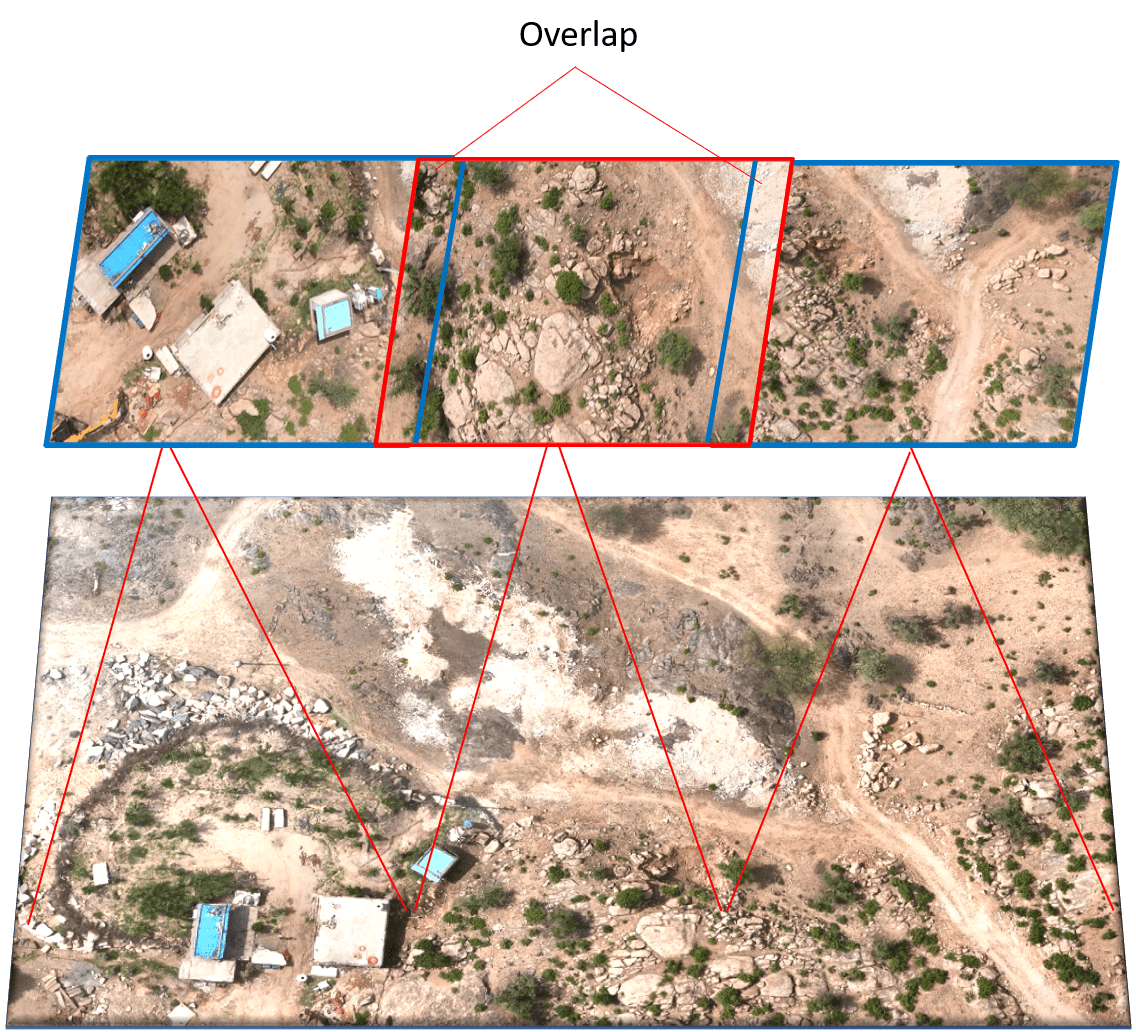
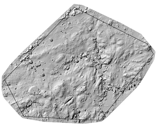
Photogrammetry is the technology of creating 3D models, orthomosaics, point clouds, or other geospatial data from a series of overlapping photographs or images.
SurveyGyaan by Surveyaan
08.01.24 11:12 AM - Comment(s)
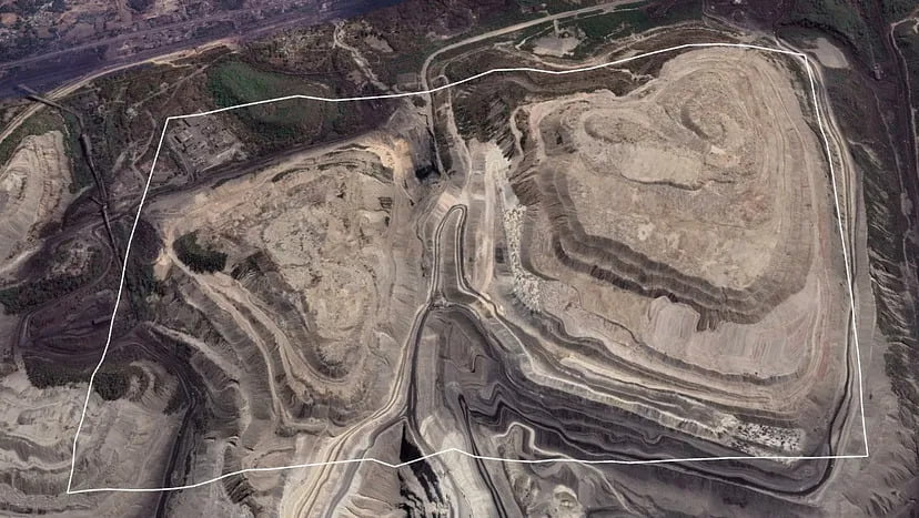
The Government has updated the SOP for drone surveys and submission of Digital Aerial Images of Mining areas to the Indian Bureau of Mines.
SurveyGyaan by Surveyaan
08.01.24 07:01 AM - Comment(s)
Standard Operating Procedure (SOP) addresses guidelines for the drone pilot to follow during flight, pre-flight and post-flight procedures to ensure the highest degree of safety.
SurveyGyaan by Surveyaan
08.01.24 06:29 AM - Comment(s)
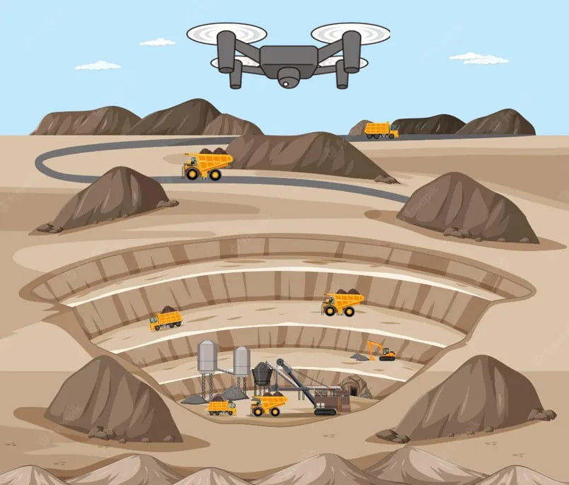
Surveying large areas present significant challenges in terms of battery life, overlap, covering all areas, drone range, and safety.
SurveyGyaan by Surveyaan
21.12.23 02:27 PM - Comment(s)
We saw the initial planning phase of drone mapping in one of our previous blog. In this blog, we will discuss the Data Collection phase and how paramount it is to choose the right
SurveyGyaan by Surveyaan
21.12.23 01:34 PM - Comment(s)

Drones have come a long way in the survey and construction sectors, and their capabilities have greatly improved
SurveyGyaan by Surveyaan
14.12.23 01:40 PM - Comment(s)
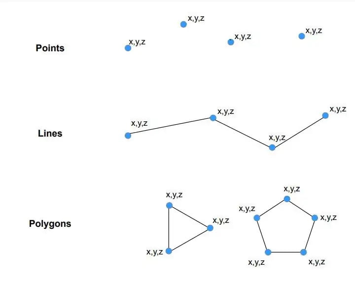
Vector data is a data structure that can be used to store spatial data. It is used to represent real-world features and assign attributes to those features.
SurveyGyaan by Surveyaan
13.12.23 12:52 PM - Comment(s)
Raster data is made up of pixels (also referred to as grid cells). Each pixel is associated with a specific geographical location. Raster data is an abstraction of the real world.
SurveyGyaan by Surveyaan
12.12.23 01:42 PM - Comment(s)
Volumetric measurements are done using aerial or ground surveying techniques to calculate the volume of stockpiles and other materials.
SurveyGyaan by Surveyaan
25.04.23 09:59 AM - Comment(s)
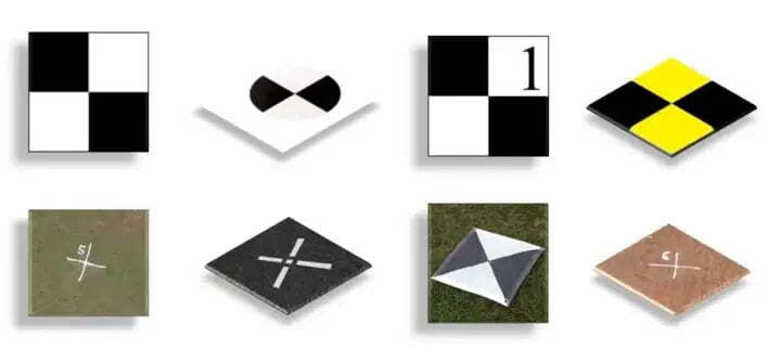
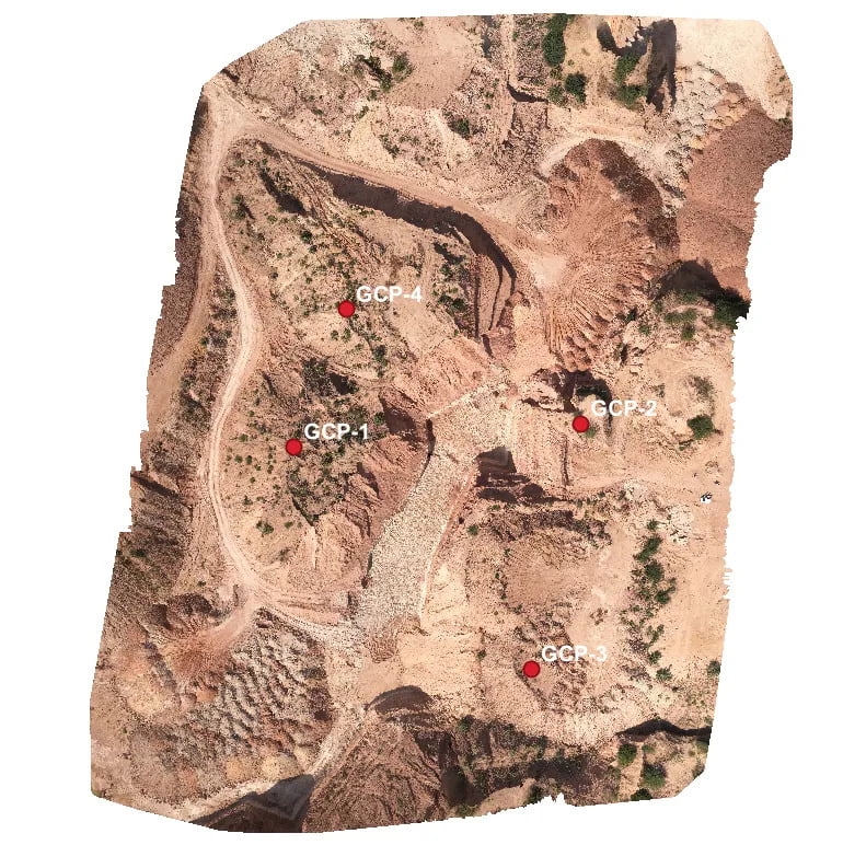
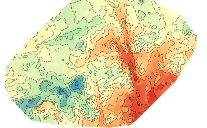
Ground Control Points (GCPs) are defined as the points on the surface of the earth which help to georeference raster data such as satellite, aerial, or drone imagery.
SurveyGyaan by Surveyaan
06.12.22 05:46 AM - Comment(s)
