Blog categorized as Uncategorized
Tilt compensation allows a GNSS receiver to accurately record positions even when the pole is not held vertically. This is made possible by integrating sensors like IMUs (Inertial Measurement Units) into the receiver.
SurveyGyaan by Surveyaan
02.07.25 10:44 AM - Comment(s)
In this blog, we’ll break down what DGNSS and drone surveying are, how they work together, and why industries like mining, construction, road and railway departments are shifting to these modern tools.
SurveyGyaan by Surveyaan
02.07.25 10:44 AM - Comment(s)

In this blog, we’ll explore the importance of IMU in GNSS, how it enhances accuracy, and why it’s a game-changer for high-precision applications.
SurveyGyaan by Surveyaan
30.04.25 11:17 AM - Comment(s)

Learn everything you need to know about obtaining a Unique Identification Number (UIN) for drones in India. This step-by-step guide covers drone categories, DGCA regulations, eligibility, application process via Digital Sky, and the importance of drone registration for safe and legal operations.
SurveyGyaan by Surveyaan
10.04.25 11:32 AM - Comment(s)

In this blog, we outline essential best practices for DGNSS surveying, including how to set up your base and rover stations, prepare for field conditions, and choose the right positioning techniques (Static, RTK, PPK, or Rapid Static).
SurveyGyaan by Surveyaan
10.04.25 09:17 AM - Comment(s)

In this blog, we break down one of the most persistent myths in the surveying industry: the belief that more channels in a DGNSS receiver automatically mean better performance.
SurveyGyaan by Surveyaan
10.04.25 06:28 AM - Comment(s)
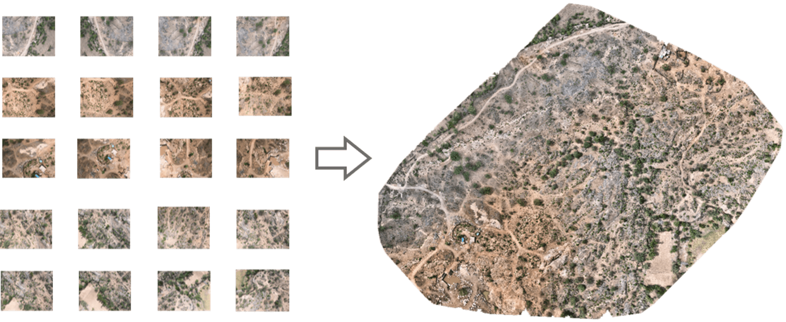
In this blog, we’ll take a closer look at orthomosaics, how they are created, and their wide-ranging applications across diverse range of fields.
SurveyGyaan by Surveyaan
09.01.24 06:50 AM - Comment(s)
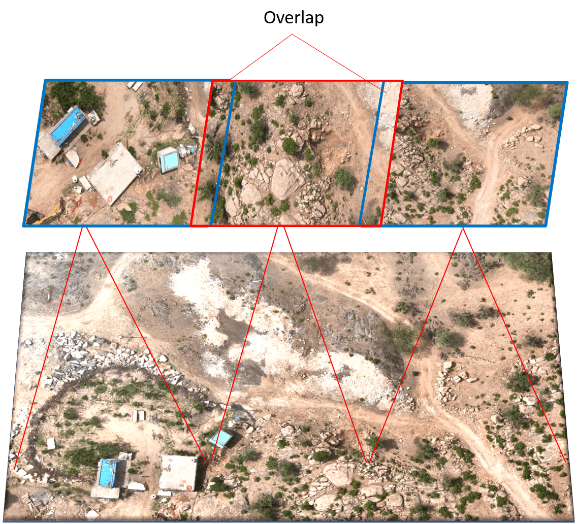
Photogrammetry is the technology of creating 3D models, orthomosaics, point clouds, or other geospatial data from a series of overlapping photographs or images.
SurveyGyaan by Surveyaan
08.01.24 11:12 AM - Comment(s)
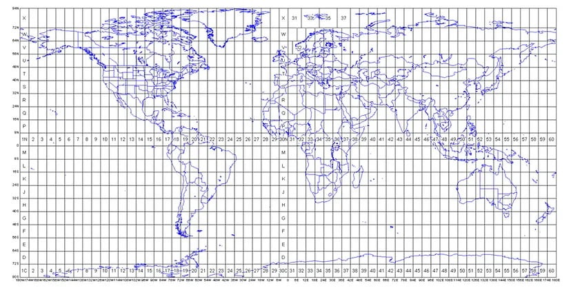
The Projected Coordinate System helps you to project a specific round-earth model onto a flat surface or map.
SurveyGyaan by Surveyaan
04.01.24 01:28 PM - Comment(s)
