The Projected Coordinate System helps you to project a specific round-earth model onto a flat surface or map. PCS are created by projecting the 3D GCS onto a 2D surface. The projected coordinate system tells the data on how to draw on a flat surface. There are many different map projections, and each displays the earth differently. Some are good for preserving areas on your map, others for keeping angles or distances.
The Projected coordinate system place points on 2-dimensional projections rather than using degrees to represent points on a spheroid. These coordinate systems frequently express the x and y coordinates for particular points using measurements in feet or meters. The benefits of these systems include easy-to-express and understand coordinates and more short distance and area calculations due to constant lengths and angles across the projection. Examples of projected coordinate systems include Universal Transverse Mercator (UTM), State Plane Coordinate System (SPCS), and Lambert Conformal Conic.
Converting from 3d to flat surfaces may cause distortions.
- Area — These projections preserve the area of specific features. The Albers Equal Area Conic projection is an example of an equal area projection.
- Shape — These projections preserve local shape for small areas. The Lambert Conformal Conic projections is an example of equal shape projections.
- Distance — These projections preserve the distances between certain points by maintaining the scale of a given data set. The Equidistant Conic projection is an example of equidistant projection.
- Direction — These projections preserve the direction from one point to all other points by maintaining some of the great circle arcs. The Lambert Equal Area Azimuthal projection is an example of a projection that preserve direction.
No projection can preserve all of these spatial properties
Depending on the projection used, different spatial properties will appear distorted. Projections are designed to minimize the distortion of one or two of the data’s characteristics, yet the distance, area, shape, direction, or a combination of these properties might not be accurate representations of the data that is being modeled. There are several types of projections available.
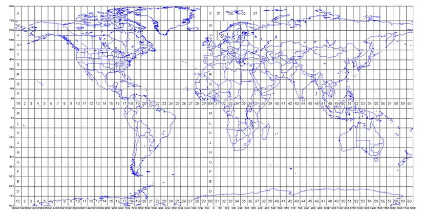
Universal Transverse Mercator
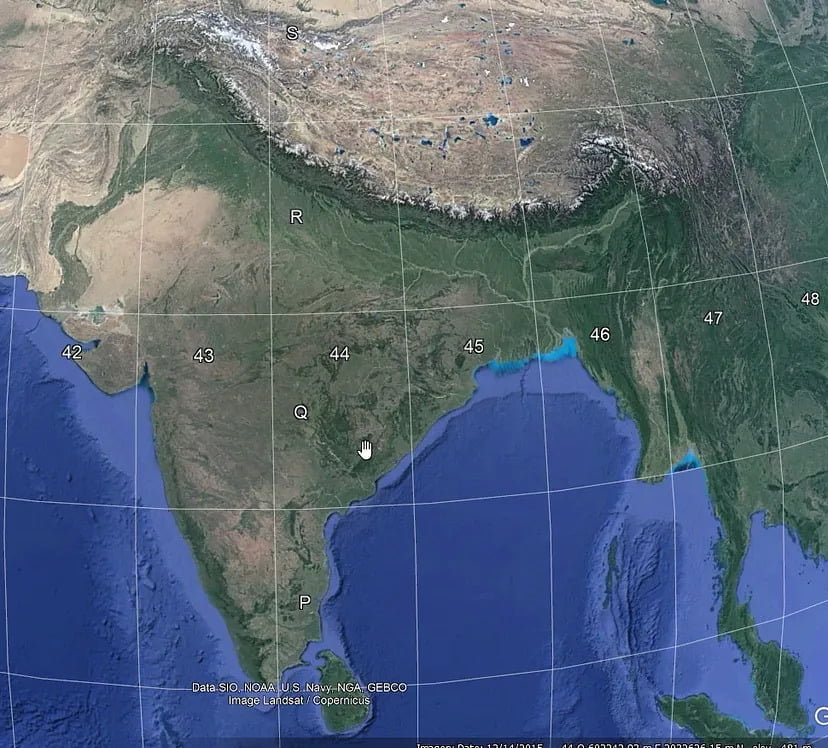
As you can see from the figure, India is covered by six UTM zones to minimize distortion. The zones are UTM 42N, UTM 43N, UTM 44N, UTM 45, UTM 46N, and UTM 47N. The N after the zone means that the UTM zones are north of the equator.
The UTM projection minimizes distortion within that zone. Distortion is small near the central meridian, and as you move away it worsens. It is difficult to use UTM if your area of interest covers more than one UTM zone. Therefore, using the UTM coordinate system is not the best choice for mapping extremely large areas.
The UTM zone number, zone letter, and the easting and northing planar coordinate pair in that zone give a position on the Earth.
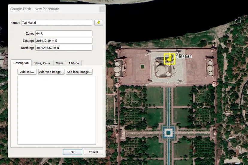
For example, the location of the Taj Mahal is 27°10' 30.36"N and 78 2' 31.56"E in Geographic Coordinate System. After converting it to the Projected Coordinate System, we get UTM zone no 44 and zone letter R, and the grid position is 206910.89 m Easting, 3009286.62 m Northing.
Please find the video on our YouTube channel from here.
This brings us to the end of the blog. I hope this article gained some knowledge for you!
Thank you for reading.
