From the reconstruction of ancient artifacts and archaeological sites to enhancing urban planning and disaster response, photogrammetry offers a novel approach to understanding our world.
In this blog series, we will embark on a captivating journey through the realm of photogrammetry and its outputs.
Photogrammetry is a technique used to measure and map physical objects or environments using photographs. It combines the principles of photography and geometry to create accurate 3D models or measurements from 2D images. Photogrammetry is used in the military, construction, land surveying, real estate, etc.
Through the process of photogrammetry, multiple images of an object or scene are captured from different angles or viewpoints. These images are then analyzed and matched to extract precise measurements, shapes, textures, and even colors. The software algorithms used in photogrammetry can reconstruct the 3D structure of the object based on the visual information provided by the images.
In this blog, we’ll take a closer look at orthomosaics, how they are created, and their wide-ranging applications across diverse range of fields.
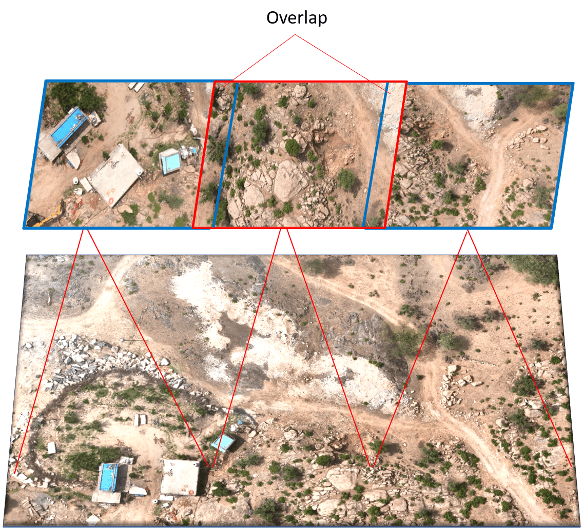
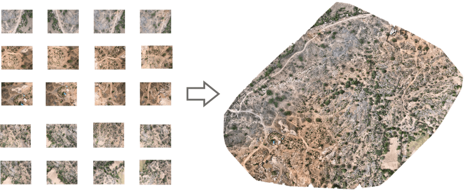
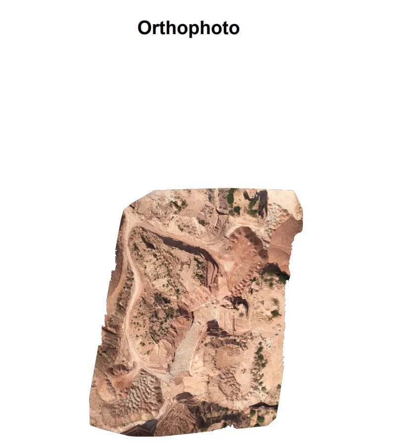
Orthomosaic map is revolutionizing the field of aerial imagery and mapping applications. They are often referred to simply as orthomosaics and are created by combining remote sensing techniques with advanced photogrammetry algorithms. Orthomosaic images can be generated from overlapping aerial photographs(orthophotos). It allows us to take a bird’s-eye view of the world, capturing vast landscapes with an unprecedented level of detail and accuracy.
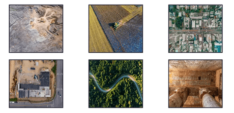
Applications
- Mining: Orthomosaic maps are used in the mining industry for monitoring mine sites, managing stockpiles and prevent enroachment.
- Agriculture: Precision agriculture relies on orthomosaics for crop monitoring, disease detection, and yield estimation.
- Urban Planning: Orthomosaics are used for urban development and infrastructure planning, including land use zoning, road design, and utility mapping.
- Construction: Monitoring construction progress, evaluating structural integrity, and analyzing terrain.
- Corridor Mapping: Inspecting tracks and roads, planning and monitoring, plotting elevation changes.
- Archaeology: Discovering and documenting ancient sites, burial mounds, and historical landscapes.
Different Formats of Orthomosaic Map
Orthomosaic maps can be generated in various formats to cater to specific needs and applications. These formats offer different levels of detail, precision, and accessibility. Here are some common formats in which orthomosaic maps are available:
Orthomosaic maps can be generated in various formats to cater to specific needs and applications. These formats offer different levels of detail, precision, and accessibility. Here are some common formats in which orthomosaic maps are available:
- GeoTIFF (Georeferenced Tagged Image File Format): GeoTIFF is one of the most widely used formats for orthomosaic maps. It combines image data with geospatial information, allowing it to be precisely located on the Earth’s surface. This format is compatible with various Geographic Information System (GIS) software and is suitable for many geospatial applications.
With the help of a Worldfile we can also import an orthomosaic into AUTOCAD and georeference it with the help of the GEOREFIMG AutoCAD command.
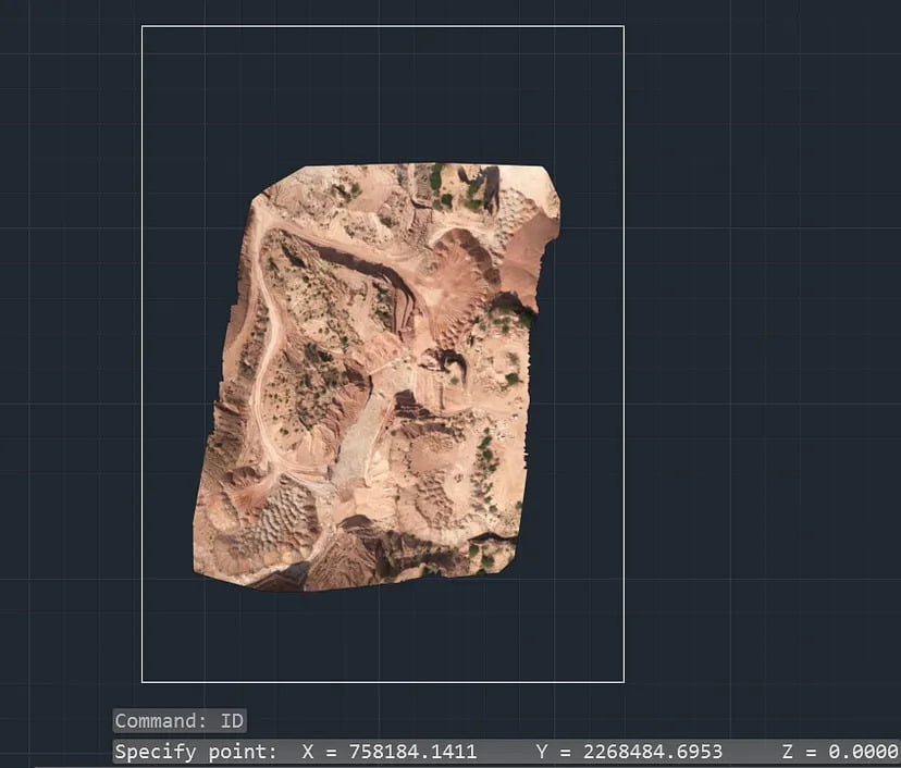
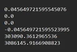
- Worldfile: It is a six line plain text sidecar file used by geographic information systems (GIS) to georeference raster map images.
- JPEG: JPEG is a common image format and orthomosaic maps can be saved as high-quality JPEG files. While they are more accessible for visualization, they may lack the georeferencing information that GeoTIFF provides.

- PDF (Portable Document Format): Orthomosaic maps can be exported as PDFs for easy sharing and printing. However, like JPEG, they may not contain geospatial data.
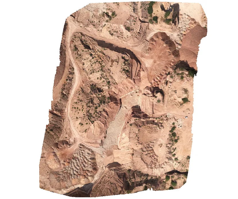
I have used Surveyaan Geoworkspace photogrammetry software to create the orthomosaic and its formats.
The possibilities of orthomosaic mapping are limitless, and as technology continues to advance, we can expect even greater achievements and innovations.
