info@nibrus.in
9606922556
Home
About Us
Product
Surveyaan-One
Geoworkspace
Application
Mining
Corridor
Agriculture
Construction
Solar
Surveying
More
Careers
Blog
Get in Touch
DEM
Blog tagged as DEM
Photogrammetry Outputs - Digital Elevation Model
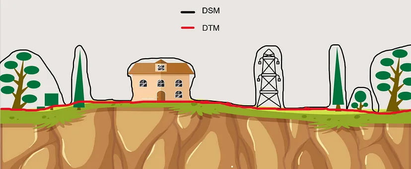
This blog will explain what DEMs are, how they differ, and how they can dramatically improve drone surveying efforts.
Read more
SurveyGyaan by Surveyaan
09.01.24 07:37 AM
-
Comment(s)
Subscribe to RSS Feed
Categories
Uncategorized
(3)
Drone Survey
(28)
Tags
Sample
dronesurvey
autocad
Surveygyaan
contours
drone survey
orthomosaic map
GCP
ground control point
digital sky
drone airspace map
drones in india
drone mapping
drone surveying
Surveyaan Geoworkspace
guidelines
overlap
IBM
Indian Bureau of Mines
sensors
photogrammetry
aerial survey
cloud-based
outputs
DEM
point cloud
las
laz
3d model
3d
GNSS
DGNSS
survey
GPS
constellations
errors