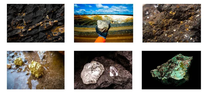
Mining is the extraction of valuable minerals or other geological materials from the earth. The profitable substances that are mined from the earth are called minerals. The minerals are valuable in their pure form, but in earth they are mixed with unwanted rocks and minerals. This mix of mineral and rock is usually carried away from the mine and processed later and refined to isolate the mineral
The Indian Bureau of Mines (IBM) established in 1948, is a multi-disciplinary government organization under the Department of Mines. It is headquartered at Nagpur, Maharashtra. It is engaged in promotion of conservation, scientific development of mineral resources and protection of environment in mines other than coal, atomic minerals, petroleum & natural gas and minor minerals. It is primarily advisory body to help in formulation of policy and legal framework for mining sector and advising Central and State Governments on development and utilization of mineral resources.
Mission
The primary mission of Indian Bureau of Mines is to promote systematic and scientific development of mineral resources of the country (both onshore and offshore), through regulatory inspections of the mines, approval of mining plans and environment management plans to ensure minimal adverse impact on environment.
It has been proposed to use a combination of digital aerial (Drone and satellite) images to monitor mining activities in the country. In mining, drones have various applications like mine surveying, inventory management, stockpile evaluation etc.
Ministry of Mines has incorporated Rule 34A in the Mineral Conservation and Development Rules 2017 for submission of digital aerial images of mining lease areas to Indian Bureau of Mines
What is MCDR?
The MCDR have been framed under section 18 of the Mines and Minerals (Development and Regulation) Act, 1957 [MMDR Act] to provide rules regarding conservation of minerals, systematic and scientific mining, development of the mineral in the country and for the protection of environment.
The MCDR have been framed under section 18 of the Mines and Minerals (Development and Regulation) Act, 1957 [MMDR Act] to provide rules regarding conservation of minerals, systematic and scientific mining, development of the mineral in the country and for the protection of environment.
The provisions of rule 34A of MCDR are as follows:
- Every lessee having
(a) an annual excavation plan of one million tonne (10 Lakh tonne) or more in a particular year, or
(b) leased area of fifty hectare or more, The above mentioned should carry out a drone survey of the leased area. They need to survey upto 100 metres outside the lease boundary in the month of April or May every year and submit the outputs or any other format as specified by IBM on or before JULY 1st every year. - Every lessee, not mentioned in the 1st rule, shall submit soft copy of high resolution Georeferenced Orthorectified Satellite images of the leased area. They need to survey upto 100 metres outside the lease boundary in the month of April to June every year and submit in GEOTIFF format along with the metadata or any other format as specified by IBM on or before JULY 1st every year. The lessee who has submitted images under the 3rd rule need not submit this result.
- Every Lessee, who needs to submit any mining plan document or modification to IBM need to carry out a drone survey. They need to survey upto 100 metres outside the lease boundary within six months before submission and shall submit the results along with the application for approval or modification of mining plan to the concerned Regional Controller of Mines and the Controller General, IBM.
- Bidders issued with a letter of intent (LOI) for grant of a mining lease shall carry out a drone survey of the mining block granted through auction. They need to survey upto 100 metres outside the lease boundary and submit the outputs along with the mining plan to the Regional Controller and the Controller General, IBM.
- The SOP for carrying out the drone survey and form of the data to be submitted shall be specified by IBM from time to time.
KML Boundary Extension
As per IBM, the drone survey should be conducted upto 100 metres outside the lease boundary. If you are confused on how to increase the lease boundary, you can extend your original KML boundary using the KML Boundary Extension free tool from this website.
Enter the website and upload your orginal KML boundary. At the top right corner input the distance in meter upto which you need to extend the boundary and click submit.
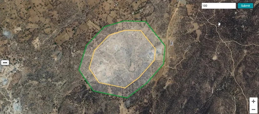
From Figure above, we can see the original KML boundary is denoted by the Yellow boundary. The green boundary is the extended boundary.
Download the official SOP for UAV Survey from here.
