With the advancement in drone technology, various sensors have been integrated into the drones to improve the sensitivity of drones for collecting critical project data and the drone’s ability to maneuver around challenging terrain. With this information, drones can also maintain their positions, determine how fast they are, and avoid obstacles.
In this article, let’s review a few of the different sensor technologies used by modern UAVS.
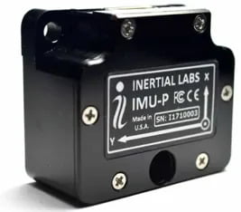
Inertial Measurement Units (IMU)
An Inertial Measurement Unit (IMU) is an electronic device that measures acceleration and rotation that can be used to calculate position and velocity. IMUs are the main component of the inertial navigation systems commonly used in aircraft, unmanned aerial vehicles (UAVs) and other unmanned systems, as well as missiles and even satellites.
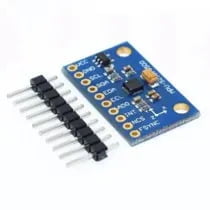
An IMU typically consists of:
Accelerometers: Measure angular velocity.
Gyroscopes: Measure angular rate.
Magnetometers(optional): measurement of the magnetic field surrounding the system
An IMU with strong vibration resistance and good performance will enhance drone flight performance.
Accelerometer
Accelerometers are used to determine the position and orientation of the drone during flight. Accelerometer is used to provide the acceleration force the drone is subjected to in all three axes, X, Y, and Z. It also determines the tilt angle of the drone in a stationary position. If the drone is static in a horizontal position, its X and Y axis will give 0g output, whereas the Z axis will give 1g output. 1g is the gravity that is experienced by every object on Earth. If the drone rotates by 90deg on the X axis, then X and Z will give 0g, and the Y axis will start giving 1g. During the tilt, X, Y, and Z will provide an output between 0 and 1g.
Accelerometer also gives linear acceleration in the horizontal and vertical directions. This data can be used to calculate the velocity, movement, and even rate of change of altitude of the drone.
Accelerometers, combined with GPS technology, allow your smartphone or fitness device to track your route when running or traveling. This can help reduce the risk of errors and ensure that the drone operates accurately.
Accelerometers also help drones to detect obstacles in their environment. By measuring the drone’s acceleration, the accelerometer can detect when it is approaching an obstacle, and the drone can adjust its course accordingly.
Accelerometers also aid in allowing a drone to maintain a stable hover and navigate its environment. For example, suppose the drone is flying in a straight line and encounters a gust of wind. In that case, the accelerometer will detect the change in acceleration, and the drone will adjust its position accordingly.
The MEMS (Micro-Electro-Mechanical System) accelerometer is the most common type used in drone systems. This small, lightweight, and cost-effective accelerometer makes it an excellent choice for drone applications. MEMS accelerometers detect changes in acceleration as small as 0.001g and measure acceleration in three axes (x, y, and z).
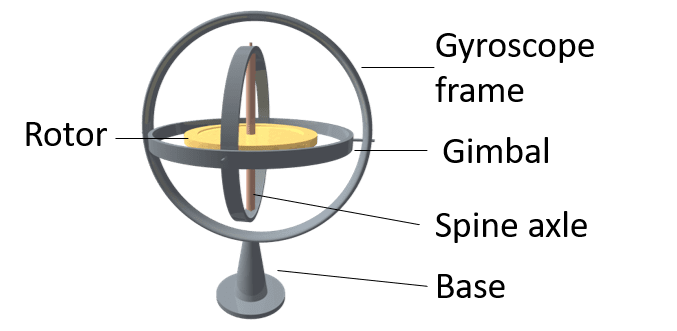
Gyroscope
Gyroscopes are versatile tool for measuring and maintaining orientation. This is especially important for drones that are used for aerial photography, as they need to remain stable and level to capture the best images. Gyroscopes are frequently combined with accelerometers, which measure linear acceleration. These two components work together to give the drone the information it needs to determine its position and orientation in three-dimensional space.
The use of gyroscope technology aids in the maintenance of a stable hover. The gyroscope detects any wayward drifting or wobbling by the drone when there is no input from the pilot. This data is then sent to a controller instructing the drone’s motors to counteract unwanted movements.
Gyroscope sensor detects angular velocity in three axes. So it can detect the angle change rate Pitch, Roll, and Yaw.
Gyroscopes also ensure that drones rotate at the exact angle user controls expect.
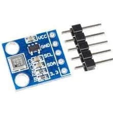
Magnetometer
A magnetometer measures a magnetic field’s intensity and direction. It gives data on the magnetic field in three X, Y, and Z. This helps the drone to determine the magnetic North and change its course accordingly. Apart from direction sensing, magnetic sensors can also detect surrounding magnetism and ferro-metals, such as electricity poles, wires, vehicles, other drones, etc., to help avoid an accident.
Barometer
Sensors that measure air pressure are called Barometers. Drones use this air pressure data to calculate their altitude.
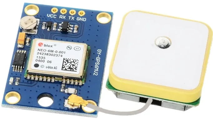
GPS Sensor
GPS technology has been critical in enabling drones to fly autonomous missions. It determines which way the aircraft should move by comparing the actual position of the drone with its targeted position and instructs the drone motors with the appropriate commands.
A drone is outfitted with a GPS receiver that can receive signals from multiple GPS satellites. Depending on the location of the satellite source, the time it takes for the drone’s GPS module to receive the signal will vary. The drone’s location can be determined by triangulating the relative position of the drone from the different GPS satellites. The precision of the location will be determined by the strength of the signal received by the drone’s GPS module and the number of satellites within its range.
The drone sensors mentioned above help design and develop drone systems. As UAV-based technologies advance, more and more industries recognize the value of combining drones and sensors. They can be valuable tools for a variety of evolving applications.
Drone pilots can appreciate all the effort that goes into keeping their miniature flying machines in the air by comprehending how these sensors function.