Understanding concepts such as coordinate reference systems and map projections is becoming increasingly crucial as drones become more common in the surveying, construction, mining, and earthwork industries.
Knowing how the coordinate system functions will aid in getting precise measurements.
Coordinate Reference System
Coordinates are ordered pairs of points that help us locate any point in a 2D plane or 3D space.
Coordinates are an instrumental piece of data in a variety of industries. Surveyors require precise points on the Earth from which to build.
A coordinate system is used to express the location of a point on a plane or sphere. Locations in two-dimensional coordinate systems are organized in a grid of columns and rows. An X and Y pair of coordinates represent each grid location. The X coordinate specifies the grid’s row and the Y coordinate specifies the column.
There are many different kinds of coordinate systems. We will be discussing the two classes of coordinate systems.
Geographic Coordinate System (GCS)
A Geographic Coordinate System (GCS) is a reference framework that defines the locations of features on an earth model. These coordinates are based on an ellipsoid that approximates the Earth’s shape, allowing us to measure distances and angles between different points of the Earth. In Geographic Coordinate System, locations are defined using angular measurements, usually in decimal degrees. A GCS is required for the data to pinpoint its location on the earth’s surface accurately. The most commonly used geographic coordinate system is the World Geodetic System 1984 (WGS 84).
To represent a location in GCS, you need the location in either degree minute seconds or decimal degrees. This is an example of GCS.
Let us find out the location of the Bangalore Cantonment Railway Station. Consider the location of the railway station to be 12°59'37.38"N and 77°35'52.87"E in Geographical Coordinate System. Here the location is in Degree Minute Second format.
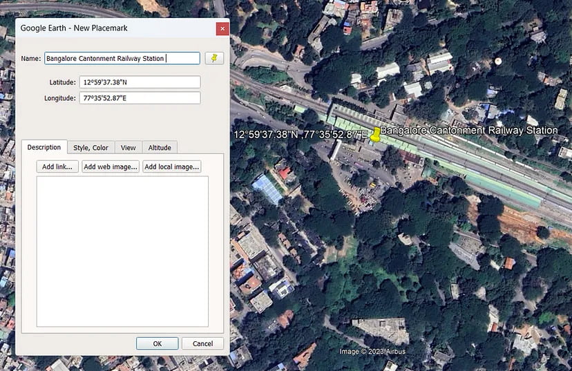
Suppose you are wondering how to convert Degree Minute Second to Decimal Degrees. In that case, you can use the degree minute second to decimal degree converter tool from Surveyaan Geoworkspace to convert the coordinates.
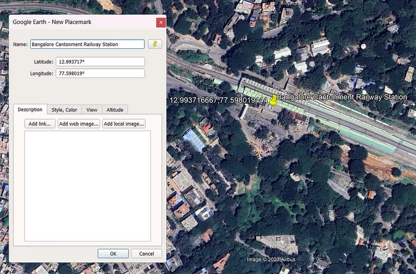
Once we convert the coordinates to decimal degrees, we get these coordinates 12.99371,77.598019.
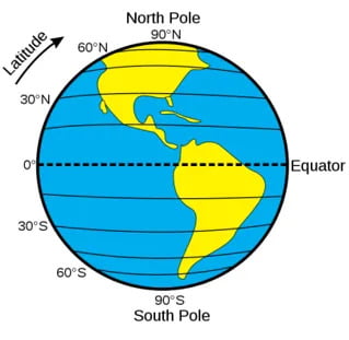
From the figure above, we can see horizontal lines run east — west. They are called Latitudes or Parallels. They form concentric circles around the Earth and are equally spaced and parallel to one another. The Equator is the line of latitude that cuts across the center of the Earth and marks zero degrees of latitude. Positive latitudes from 0 to +90 degrees are found north of the equator, while negative latitudes from 0 to -90 degrees are located south of the equator.
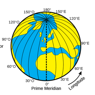
From the figure above, we can see vertical lines run north — south. They are called Longitudes or Meridians. The Prime Meridian is the line of longitude that is at zero degrees and runs from the North Pole to the South Pole. For most geographic coordinate systems, the prime meridian is the longitude that passes through Greenwich, England. Positive longitudes from 0 to +90 degrees are found east of the Prime Meridian, while negative longitudes from 0 to -90 degrees are located west of the Prime Meridian.
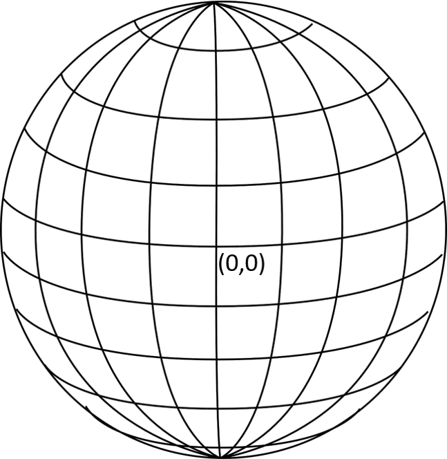
From the figure above, the grid-like network of latitude and longitude lines encircles the entire globe and is called the Graticule. The equator and prime meridian intersection define the origin of the graticule (0,0).
A spheroid or a sphere approximating the Earth’s shape can define a coordinate system. A sphere is based on a circle, whereas a spheroid is an ellipsoid based on an ellipse.
While a spheroid approximates the earth’s shape, a Datum defines the position of the spheroid relative to the center of the earth. A datum provides a frame of reference for measuring locations on the earth’s surface. It defines the origin and orientation of latitude and longitude lines.
There are many different models of the earth’s surface and, therefore, many different GCS. World Geodetic System 1984 (WGS 1984) is designed as a one-size-fits-all GCS, good for mapping global data. Australian Geodetic Datum 1984 is designed to fit the earth snugly around Australia, giving you good precision for this continent but poor accuracy anywhere else.
Whenever you change the datum, or the geographic coordinate system, the coordinate values of your data will change.
This brings us to the end of the blog. I hope this article gained some knowledge for you!
Thank you for reading.
