If you own a drone, there’s a good chance you may not be aware of the areas in which you can fly it. The DGCA’s interactive airspace map can assist you in this regard.
The Ministry of Civil Aviation launched an airspace map of India for drone operations on 24 September 2021 for the first time. It enables civilian drone operators to check for delineated no-fly zones or areas where certain formalities must be completed before flying a drone. The map is available on the Directorate General of Civil Aviation’s (DGCA) digital sky platform.
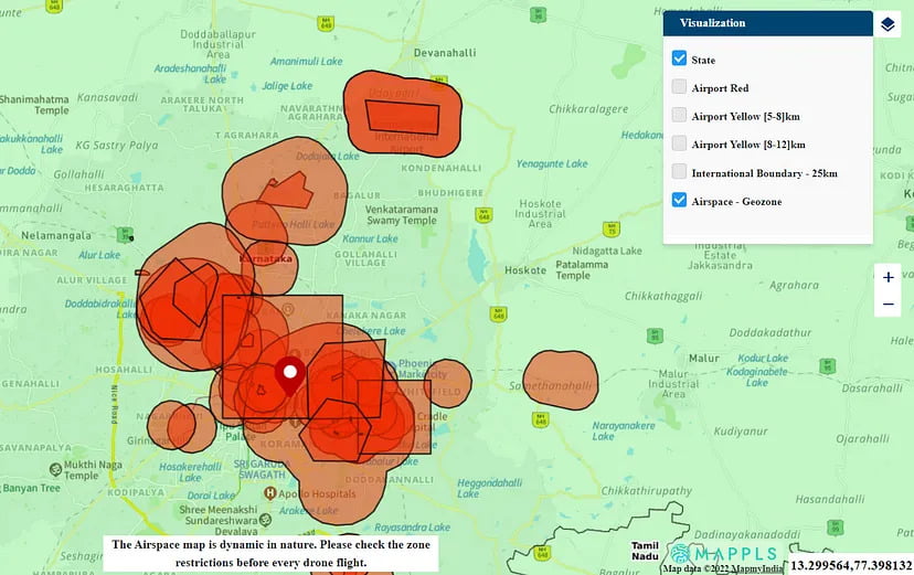
The drone airspace map is an interactive map of India that demarcates the country’s red, yellow, and green zones. Anyone planning to operate a drone should mandatorily check the latest airspace map for any changes in zone boundaries from the digital sky website.
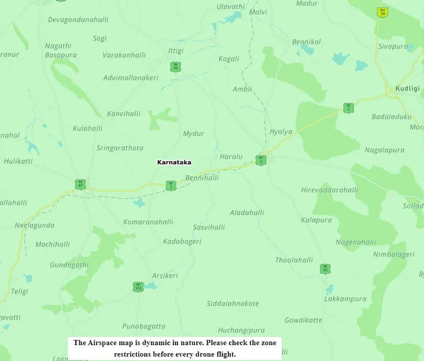
Green zones are unrestricted zones where drones can be operated without any permission. The green zone is the airspace up to 120 m/400ft that has not been identified as a red or yellow zone. Permission is unnecessary to operate drones weighing up to 500 kg in green zones.
Yellow zones are controlled zones, and the drone can only be operated after permission from DGCA. The yellow zone is the airspace up to 120m/400ft in a designated green zone, up to 60m/200ft in the vicinity of an operating airport that is between 8 and 12 kilometers away, and above ground in the vicinity of an operational airport that is between 5–8 kilometers away.
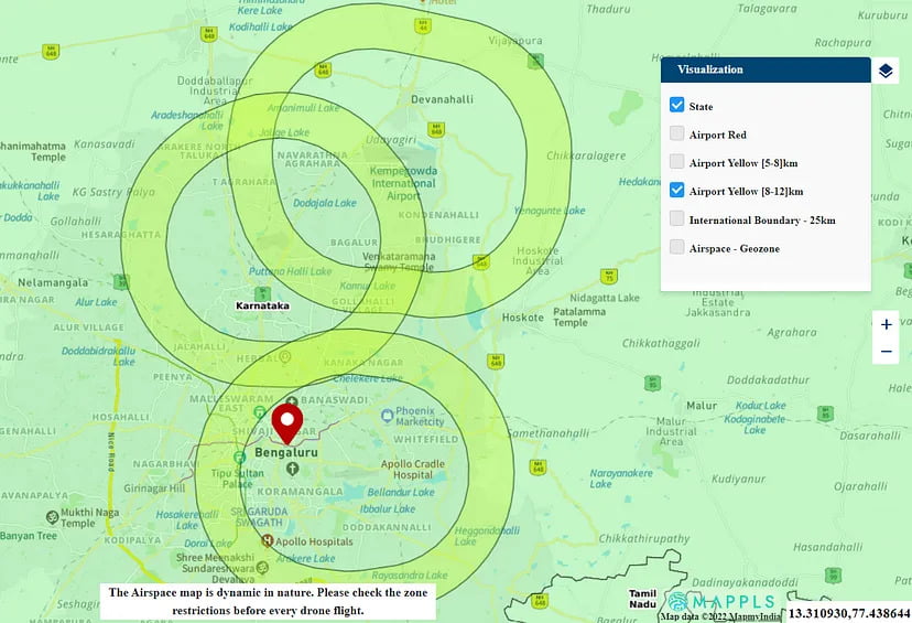
From Figure 2 above, In the Airport Yellow [8–12 km] zone, drones can be operated only up to 60m/200ft. You need to take permission from the authorities in order to fly above this height.
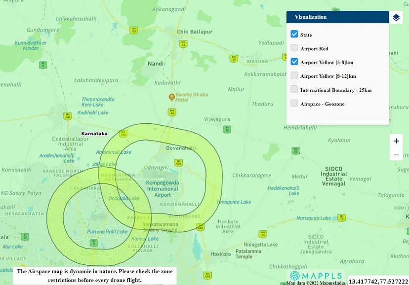
From Figure 3 above, In the Airport Yellow [5–8 km] zone, drones can be operated only after permission from DGCA.
Red zones are highly restricted zones or No Drone zones, and drones can be operated only after permission from DGCA.
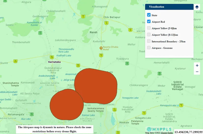
From Figure 4 above, drones can be operated only after permission from the authorities in the Airport RED zone.
Geozones are temporary zones. They keep getting updated on the website. These are areas where construction or other such activities is happening.
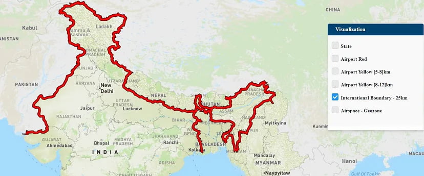
There are international boundaries besides the Green, Yellow, Red, and Geo Zones. This is a highly restricted zone. You are not allowed to fly the drone here
Remote Pilot License
In India, Drone Pilot Training is now mandatory to fly a commercial-purpose drone of any size. To become a professional drone pilot in India, candidates must obtain a drone pilot license upon completing training from a DGCA (Directorate General of Civil Aviation) approved institute. Flying a drone without the required certificate can result in severe fines and drone confiscation.
To be eligible for the program, One must be at least 18 years old and under 65. They should also have a minimum qualification of Class 10. Candidates must also pass a medical examination and a background check from the relevant government agency. It is not necessary to own a drone to enlist.
The digital sky website lists institutes and universities that offer DGCA-approved drone pilot training courses. There are currently 48 DGCA-approved Remote Pilot Training Organizations (RPTOs) nationwide. You can look up the nearest Remote Pilot Training Organization (RPTO) on the digital sky website.
Please find the video on our YouTube channel from here.
This brings us to the end of the blog. I hope this article gained some knowledge for you!
Thank you for reading.
