
Drones have become increasingly popular for recreational, commercial, and industrial purposes. However, with the rise in drone usage, regulatory bodies like the Directorate General of Civil Aviation (DGCA) in India have introduced strict guidelines to ensure safety and security. One such r...
Blog by SurveyGyaan
How to apply UIN for Drones? A Complete Guide for Indian Drone Operators and Manufacturers
10.04.25 09:18 AM - Comment(s)

Best Practices for DGNSS (Differential Global Navigation Satellite System)
10.04.25 06:36 AM - Comment(s)
Systematic field procedures are part of any successful DGNSS survey that guarantees that data obtained is both accurate and reliable. Whether in terms of setting up base and rover stations or the field procedures and collection of data, the same case applies — best practices ensure results are both ...
How many Satellites and Channels require in your DGNSS?
10.04.25 05:55 AM - Comment(s)
In the realm of precision navigation and positioning, Differential GNSS (DGNSS) often emerges as a critical yet misunderstood technology. Despite its pivotal role in enhancing GPS accuracy, several myths persist, clouding its true value. Today, let’s discuss some common misconception in the survey w...
DGNSS Series - Real Time Kinematic (RTK) and Post Processing Kinematic (PPK)
01.02.24 12:44 PM - Comment(s)
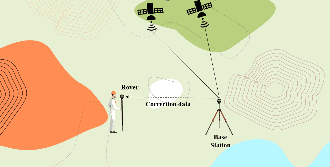
Global Navigation Satellite System (GNSS) technology has transformed how we navigate and collect location-based data. Real-Time Kinematic (RTK) and Post-Processing Kinematic (PPK) are two cutting-edge methodologies that have greatly improved the accuracy and dependability of GNSS data. In this blog ...
DGNSS Series - CORS Network
01.02.24 12:44 PM - Comment(s)
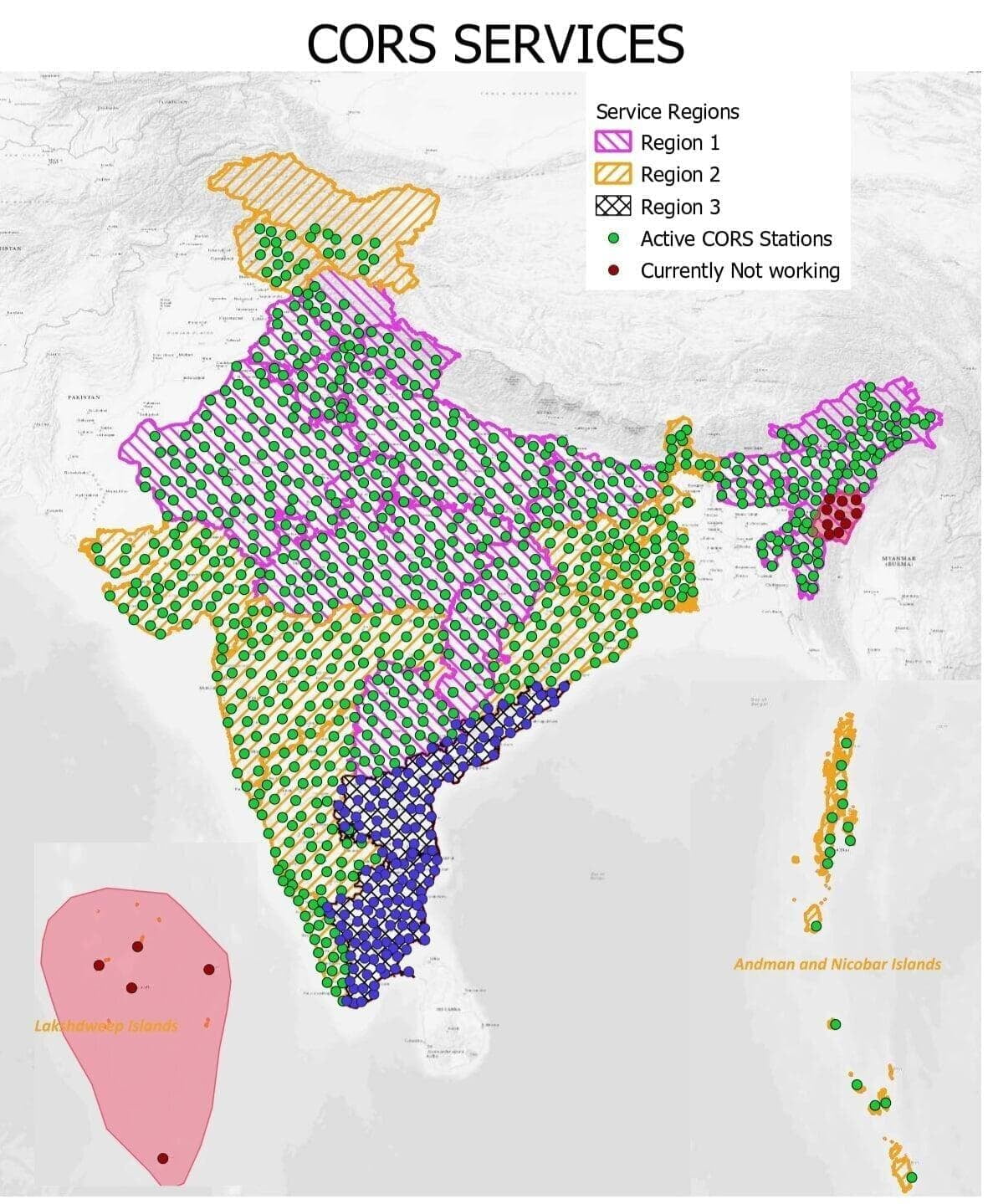
The way we monitor locations and travel on Earth has been completely transformed by global navigation satellite systems, or GNSS. These satellite constellations, which include GPS and Galileo, supply critical position data for a wide range of uses, from precise timing in financial transactions to au...