
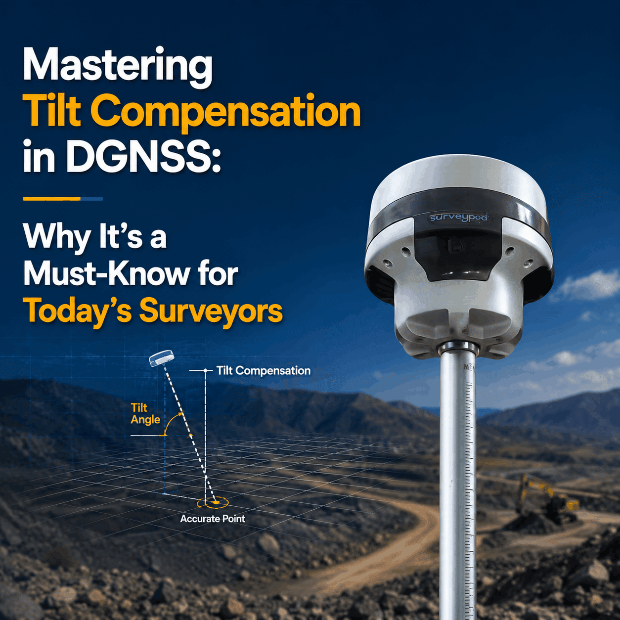
Surveying is built on precision. A few centimeters can make or break a boundary line, construction layout, or mining volume calculation. Traditionally, Differential GNSS (DGNS) receivers required the pole to be held perfectly vertical to ensure accuracy. But in real-world environments — uneven terra...
Blog tagged as DGNSS
Mastering Tilt Compensation in DGNSS: Why It’s a Must-Know for Today’s Surveyors
02.07.25 10:15 AM - Comment(s)
The Importance of IMU in GNSS:& Enhancing Accuracy Reliability
30.04.25 10:36 AM - Comment(s)

Global Navigation Satellite Systems (GNSS) like GPS, GLONASS, Galileo, and BeiDou provide essential positioning data for navigation, surveying, and autonomous systems. However, GNSS signals can be disrupted by obstacles like buildings, tunnels, or dense foliage. This is where an Inertial Measur...
Best Practices for DGNSS (Differential Global Navigation Satellite System)
10.04.25 06:36 AM - Comment(s)
Systematic field procedures are part of any successful DGNSS survey that guarantees that data obtained is both accurate and reliable. Whether in terms of setting up base and rover stations or the field procedures and collection of data, the same case applies — best practices ensure results are both ...
How many Satellites and Channels require in your DGNSS?
10.04.25 05:55 AM - Comment(s)

In the realm of precision navigation and positioning, Differential GNSS (DGNSS) often emerges as a critical yet misunderstood technology. Despite its pivotal role in enhancing GPS accuracy, several myths persist, clouding its true value. Today, let’s discuss some common misconception in the survey w...
DGNSS Series - CORS Network
01.02.24 12:44 PM - Comment(s)
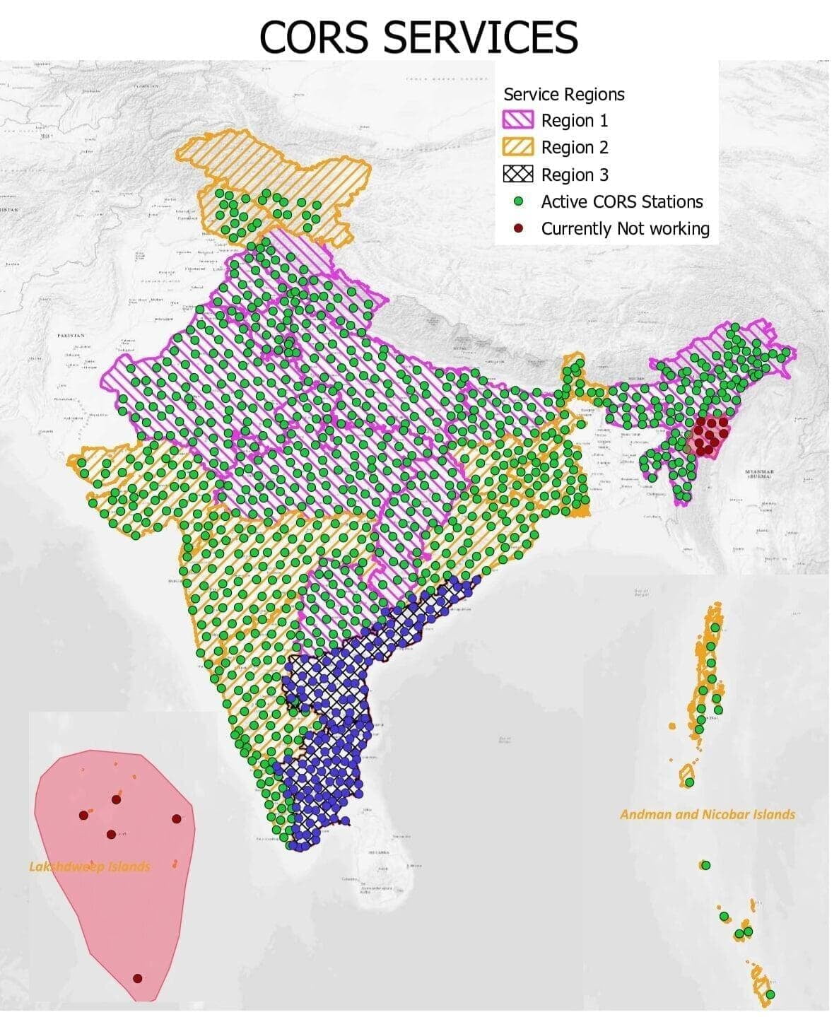
The way we monitor locations and travel on Earth has been completely transformed by global navigation satellite systems, or GNSS. These satellite constellations, which include GPS and Galileo, supply critical position data for a wide range of uses, from precise timing in financial transactions to au...