
Systematic field procedures are part of any successful DGNSS survey that guarantees that data obtained is both accurate and reliable. Whether in terms of setting up base and rover stations or the field procedures and collection of data, the same case applies — best practices ensure results are both ...
Blog categorized as Uncategorized
Best Practices for DGNSS (Differential Global Navigation Satellite System)
10.04.25 06:36 AM - Comment(s)
How many Satellites and Channels require in your DGNSS?
10.04.25 05:55 AM - Comment(s)

In the realm of precision navigation and positioning, Differential GNSS (DGNSS) often emerges as a critical yet misunderstood technology. Despite its pivotal role in enhancing GPS accuracy, several myths persist, clouding its true value. Today, let’s discuss some common misconception in the survey w...
Photogrammetry Output - Orthomosaic
08.01.24 12:25 PM - Comment(s)
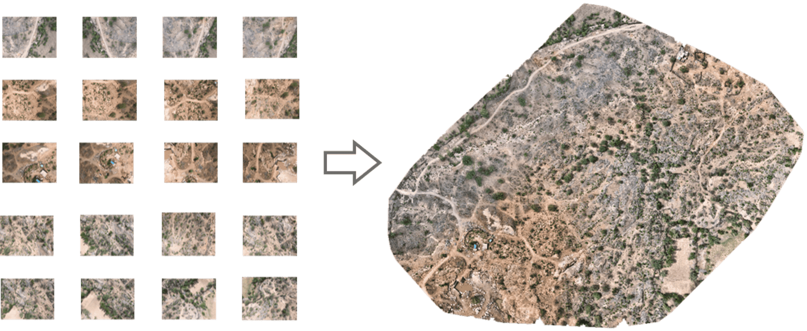
From the reconstruction of ancient artifacts and archaeological sites to enhancing urban planning and disaster response, photogrammetry offers a novel approach to understanding our world.
In this blog series, we will embark on a captivating journey through the realm of photogrammetry and its outputs...
Benefits of Cloud-based Photogrammetry Software
08.01.24 09:55 AM - Comment(s)
Photogrammetry is the technology of creating 3D models, orthomosaics, point clouds, or other geospatial data from a series of overlapping photographs or images. With photogrammetry, you can measure and model the real world with a camera. Photogrammetry is used in the military, construction, land sur...
Projected Coordinate Systems
03.01.24 01:49 PM - Comment(s)
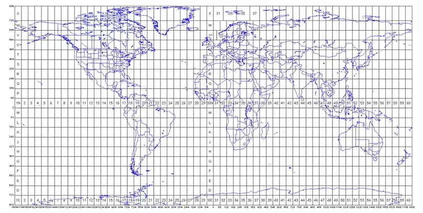
The Projected Coordinate System helps you to project a specific round-earth model onto a flat surface or map. PCS are created by projecting the 3D GCS onto a 2D surface. The projected coordinate system tells the data on how to draw on a flat surface. There are many different map projection...