Blog tagged as drone mapping
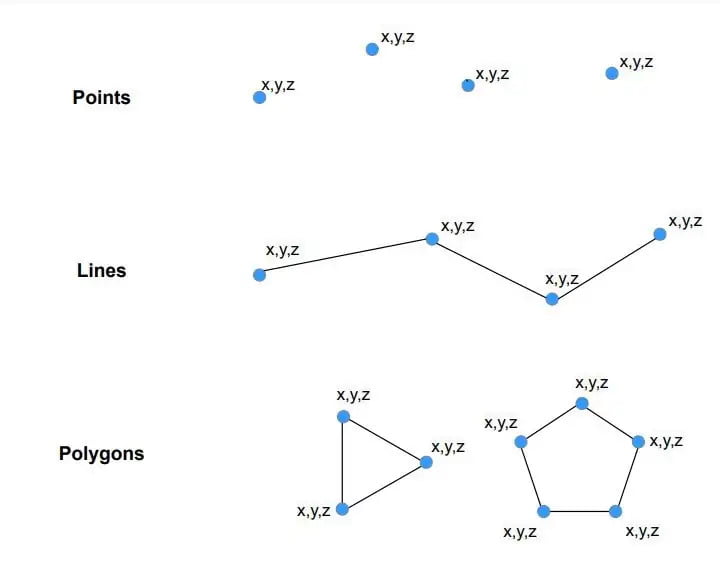
Vector data is a data structure that can be used to store spatial data. It is used to represent real-world features and assign attributes to those features.
SurveyGyaan by Surveyaan
13.12.23 12:52 PM - Comment(s)
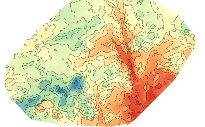
Raster data is made up of pixels (also referred to as grid cells). Each pixel is associated with a specific geographical location. Raster data is an abstraction of the real world.
SurveyGyaan by Surveyaan
12.12.23 01:42 PM - Comment(s)
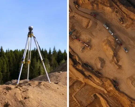
Volumetric measurements are done using aerial or ground surveying techniques to calculate the volume of stockpiles and other materials.
SurveyGyaan by Surveyaan
25.04.23 09:59 AM - Comment(s)
Surveying is a process of determining or identifying different features of a land area. It helps in planning or mapping an area.
SurveyGyaan by Surveyaan
26.01.22 06:07 AM - Comment(s)
