Blog tagged as dronesurvey

Drones have come a long way in the survey and construction sectors, and their capabilities have greatly improved
SurveyGyaan by Surveyaan
14.12.23 01:40 PM - Comment(s)
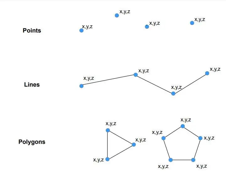
Vector data is a data structure that can be used to store spatial data. It is used to represent real-world features and assign attributes to those features.
SurveyGyaan by Surveyaan
13.12.23 12:52 PM - Comment(s)
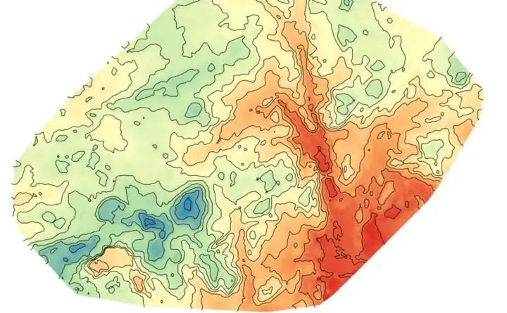
Raster data is made up of pixels (also referred to as grid cells). Each pixel is associated with a specific geographical location. Raster data is an abstraction of the real world.
SurveyGyaan by Surveyaan
12.12.23 01:42 PM - Comment(s)
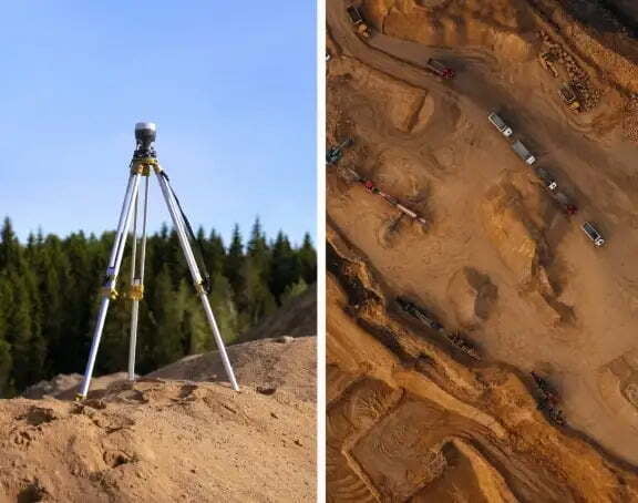
Volumetric measurements are done using aerial or ground surveying techniques to calculate the volume of stockpiles and other materials.
SurveyGyaan by Surveyaan
25.04.23 09:59 AM - Comment(s)
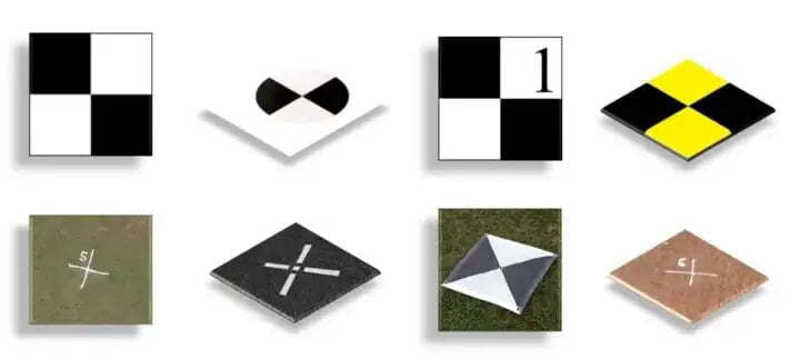
Ground Control Points (GCPs) are defined as the points on the surface of the earth which help to georeference raster data such as satellite, aerial, or drone imagery.
SurveyGyaan by Surveyaan
06.12.22 05:46 AM - Comment(s)
Contouring, in surveying, is the determination of elevation of various points on the ground.
SurveyGyaan by Surveyaan
28.01.22 11:30 AM - Comment(s)
Surveying is a process of determining or identifying different features of a land area. It helps in planning or mapping an area.
SurveyGyaan by Surveyaan
26.01.22 06:07 AM - Comment(s)
